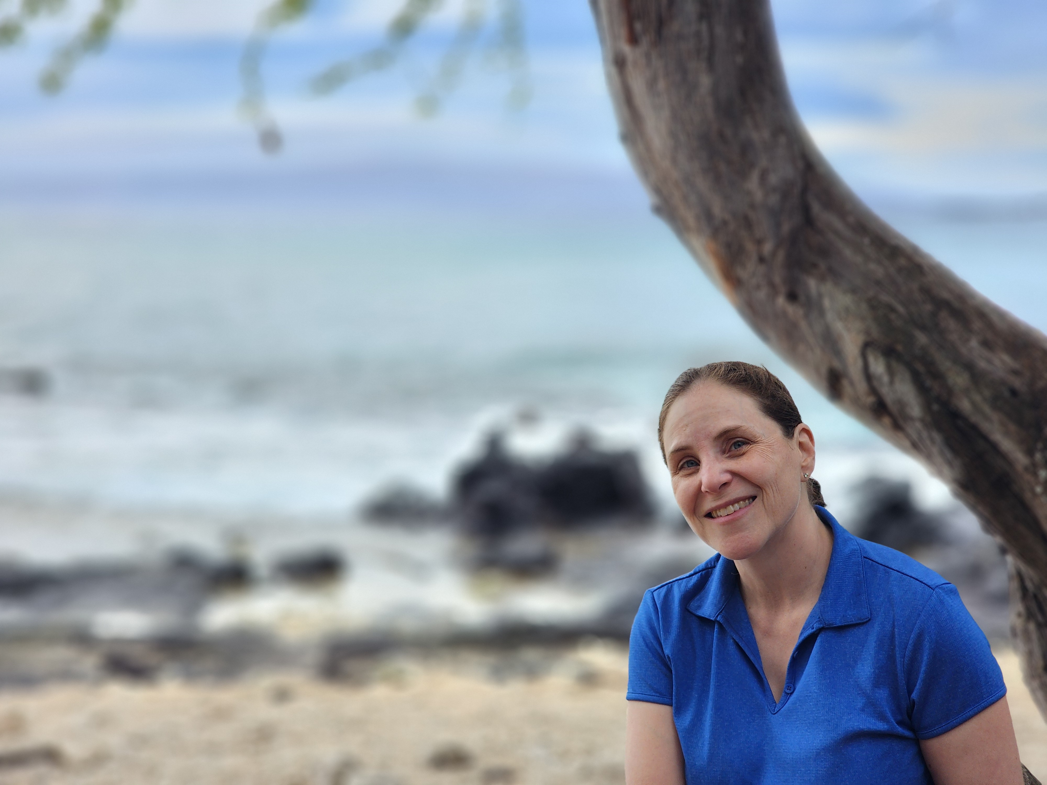
[Composed 1/5/2026]
I have a weakness for brown signs. You know the ones — those little brown highway markers that flag a historic site, a scenic overlook, some monument you've never heard of. Sure, most just hand you a plaque and a "huh, cool." But once in a while, one scores: something unforgettable. Either way, I've never seen one I didn't want to follow.
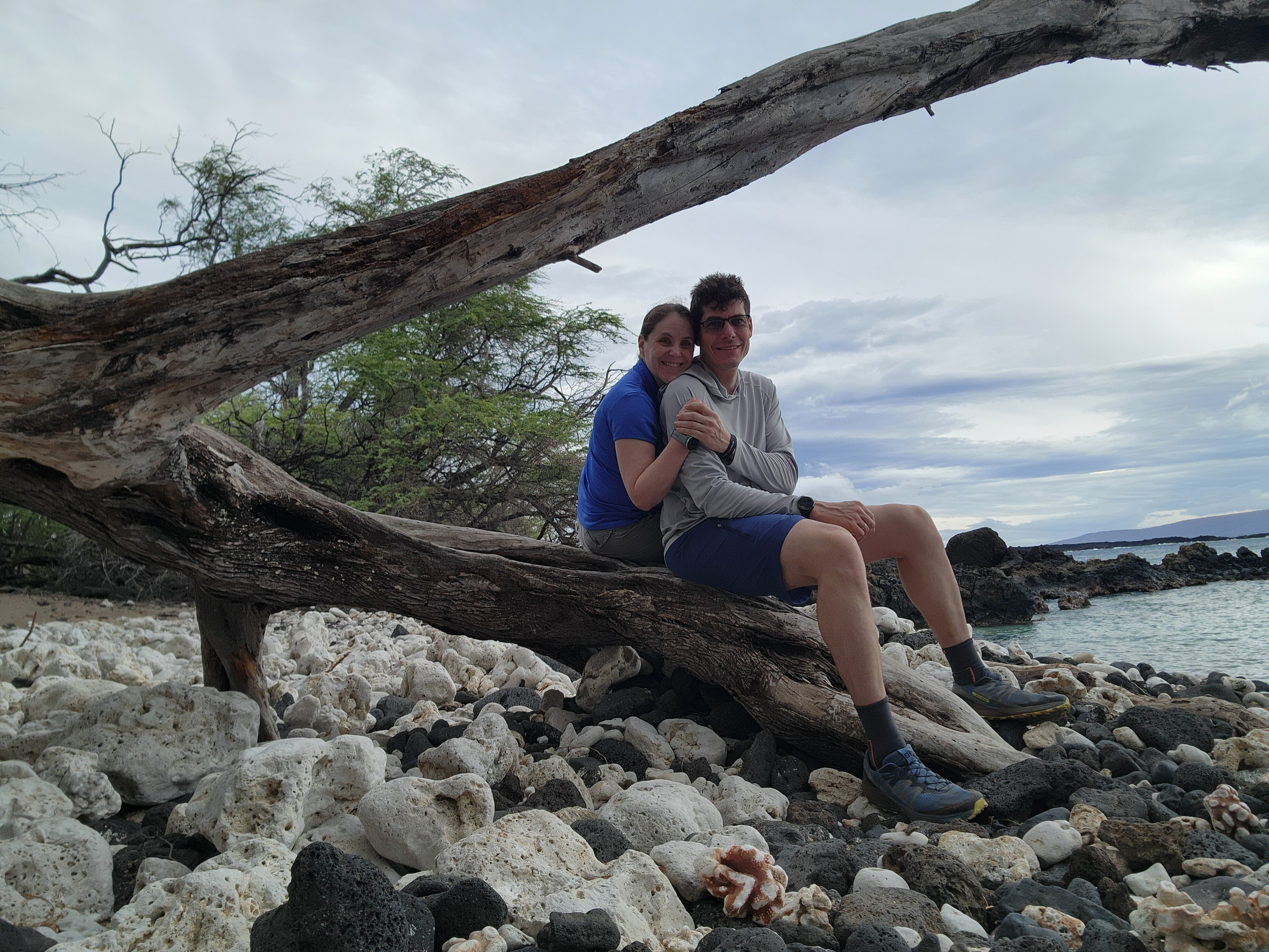
This stretch of Maui's southern coast had three of them lined up at once: the old King's Highway, a monument to the first European to set foot on the island, and — the one I really wanted — a lighthouse at the island's dry southern tip. A brown sign hat trick.
I have a thing for lighthouses. A good one is an engineering marvel: the same brutal problem — keeping ships off the rocks — solved and re-solved for centuries, built to shrug off the worst the ocean can throw at it. I wasn't sure what this one had been built to weather, but I was eager to stand before it and size it up.
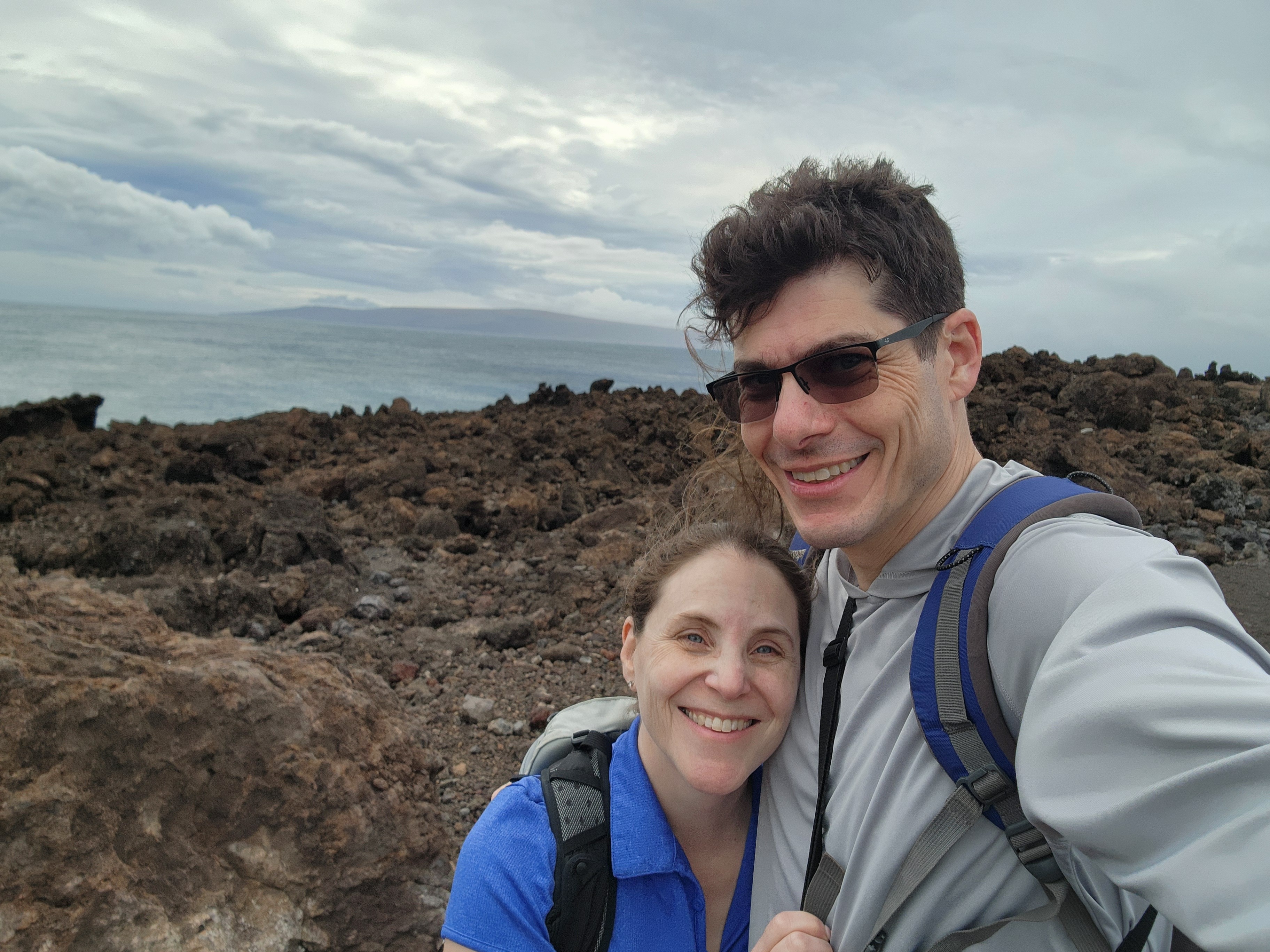
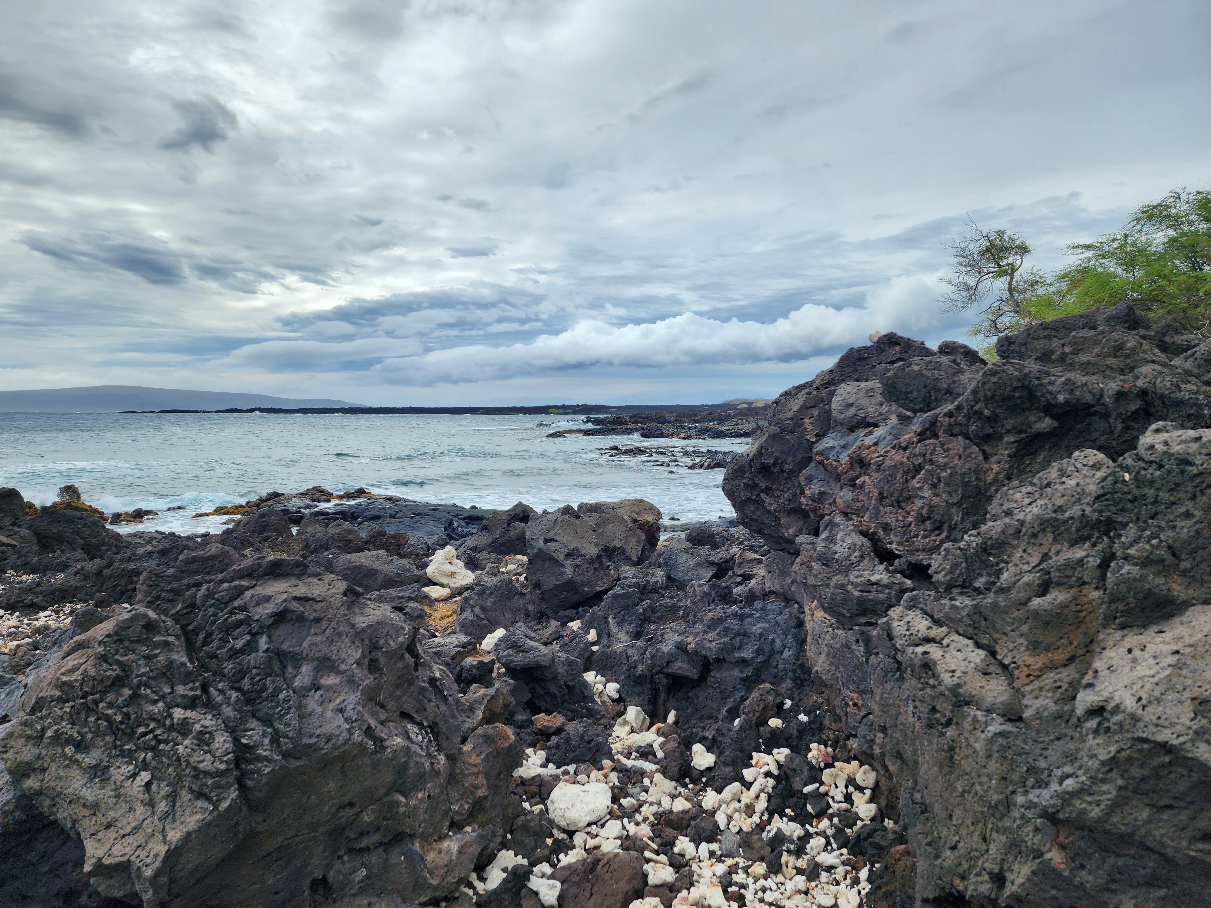
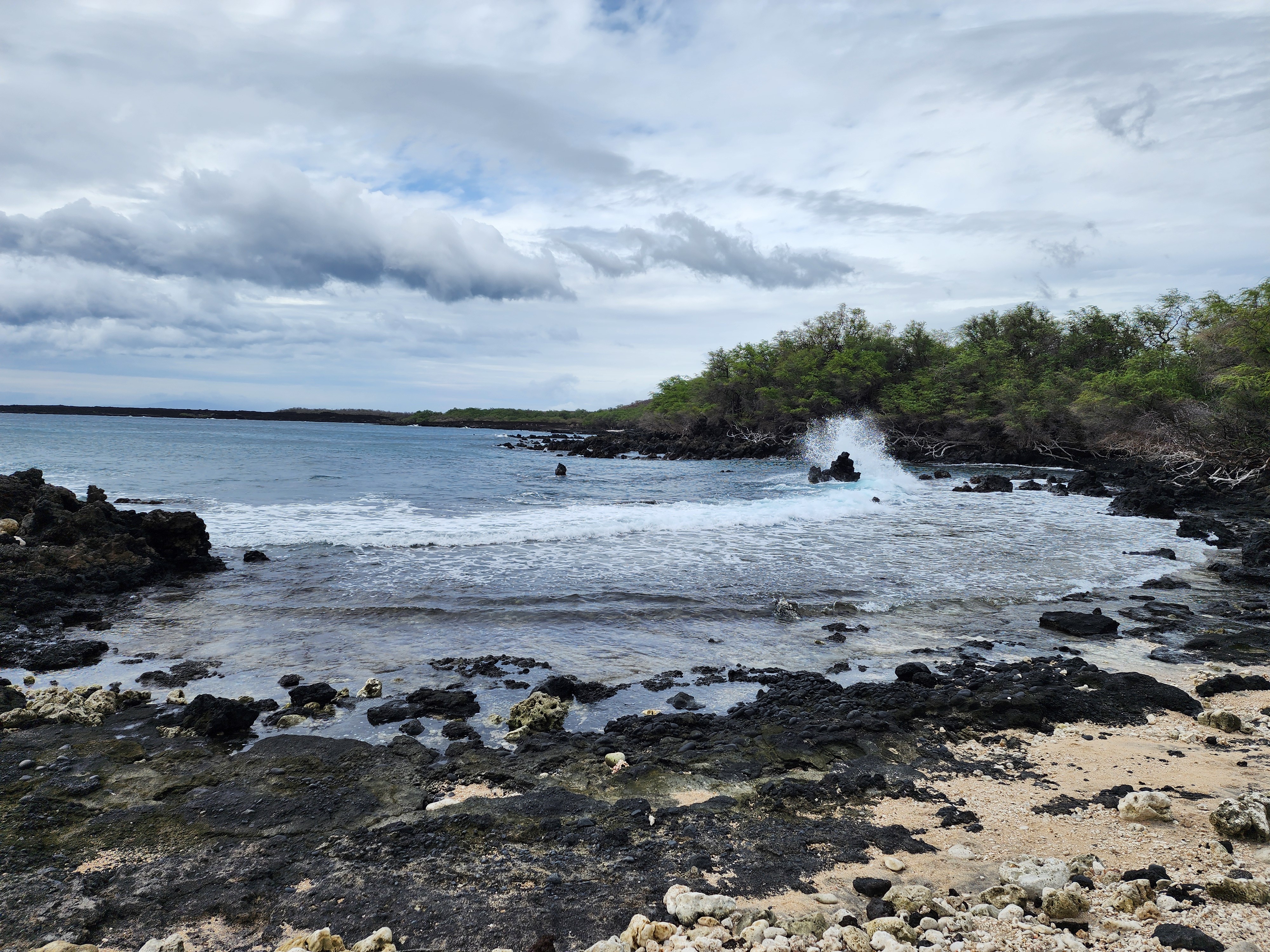
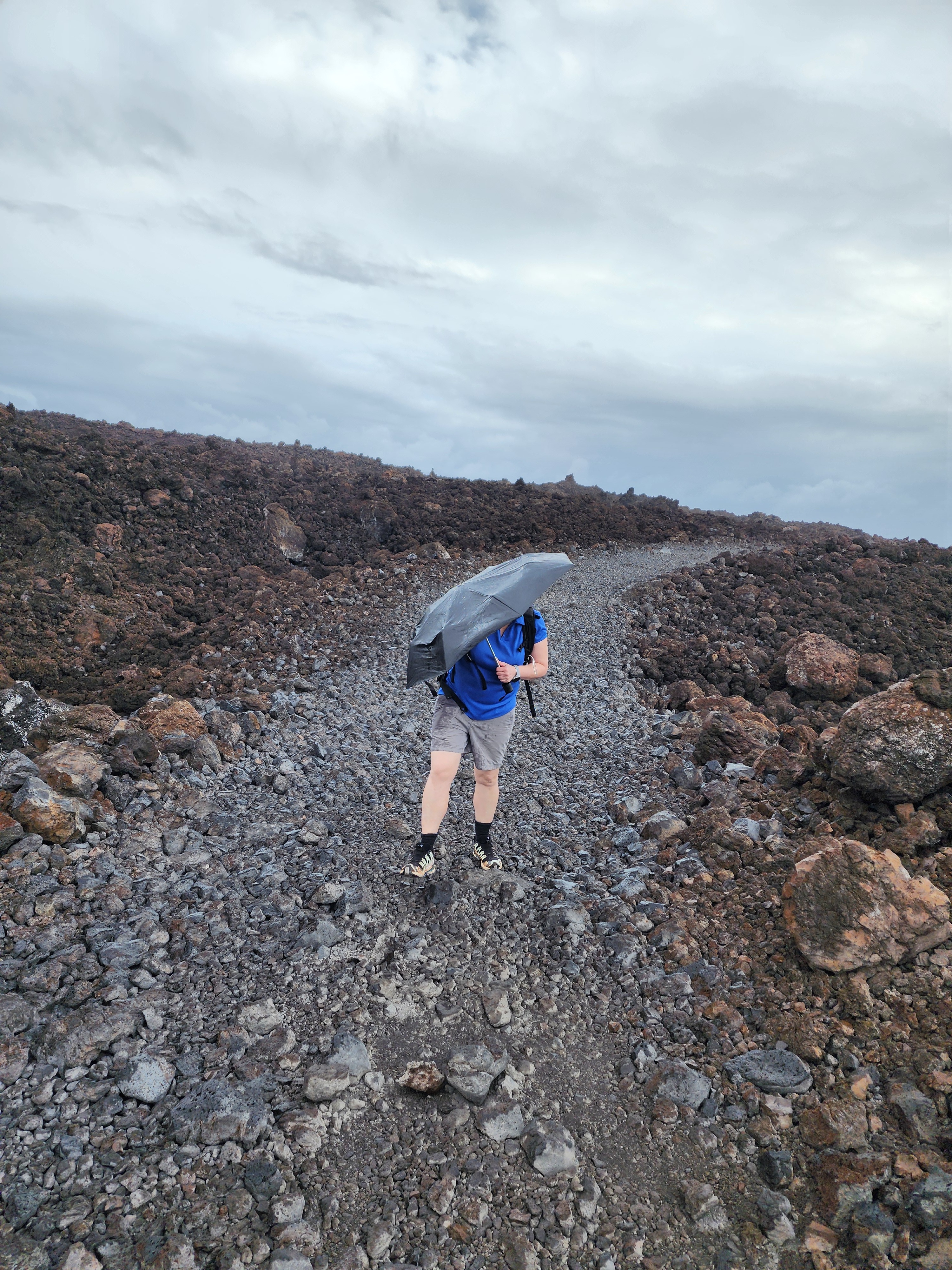
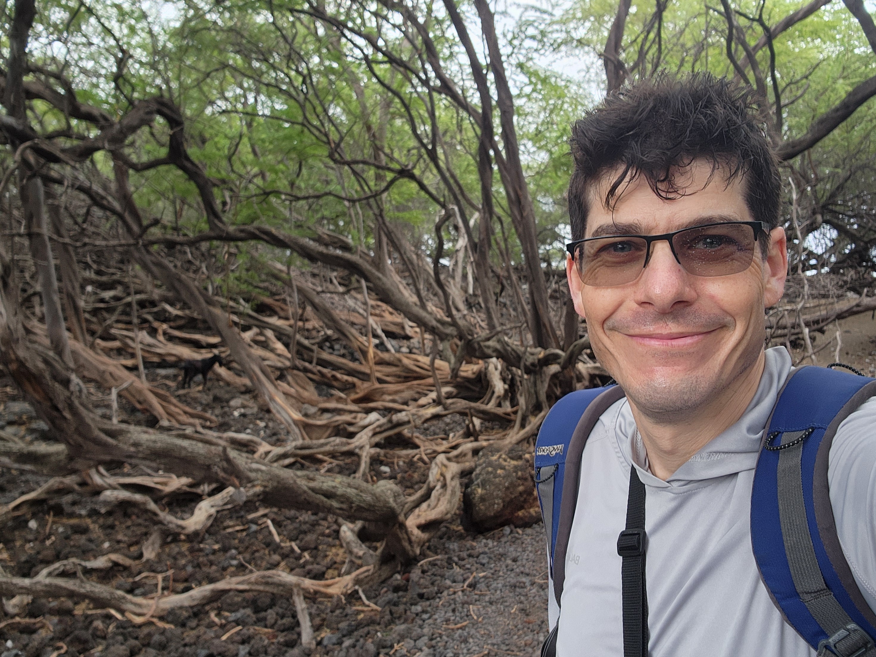
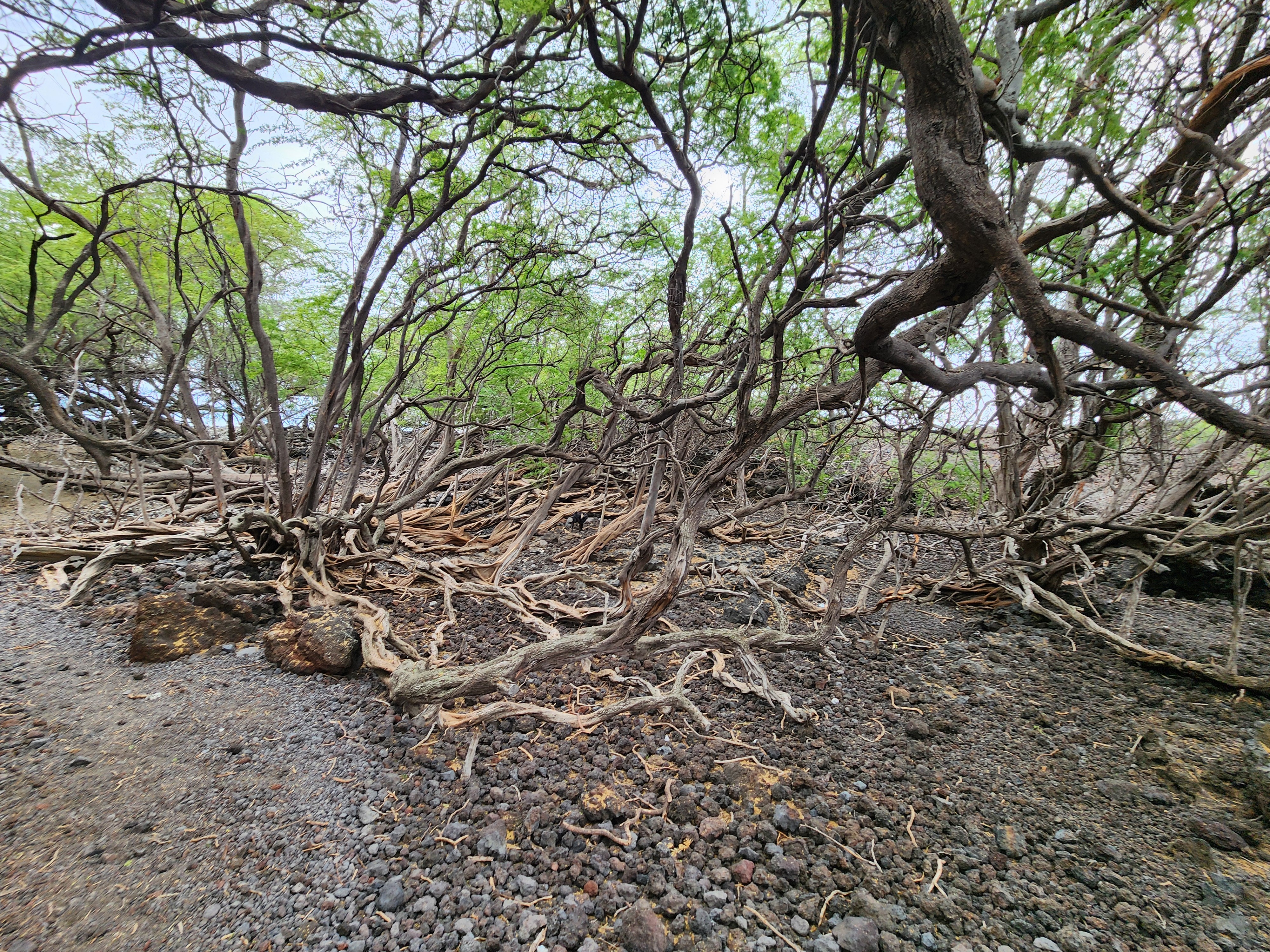
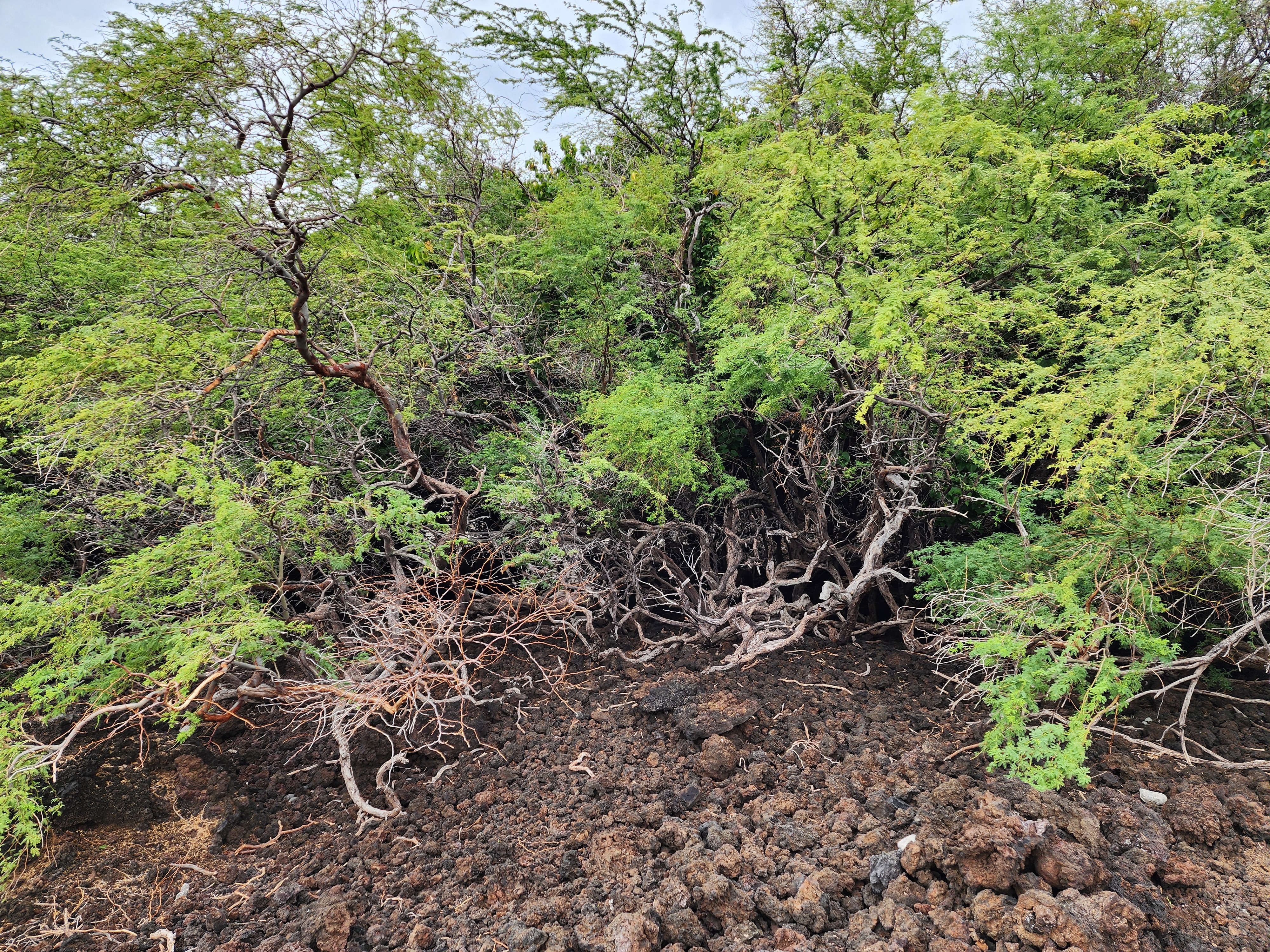
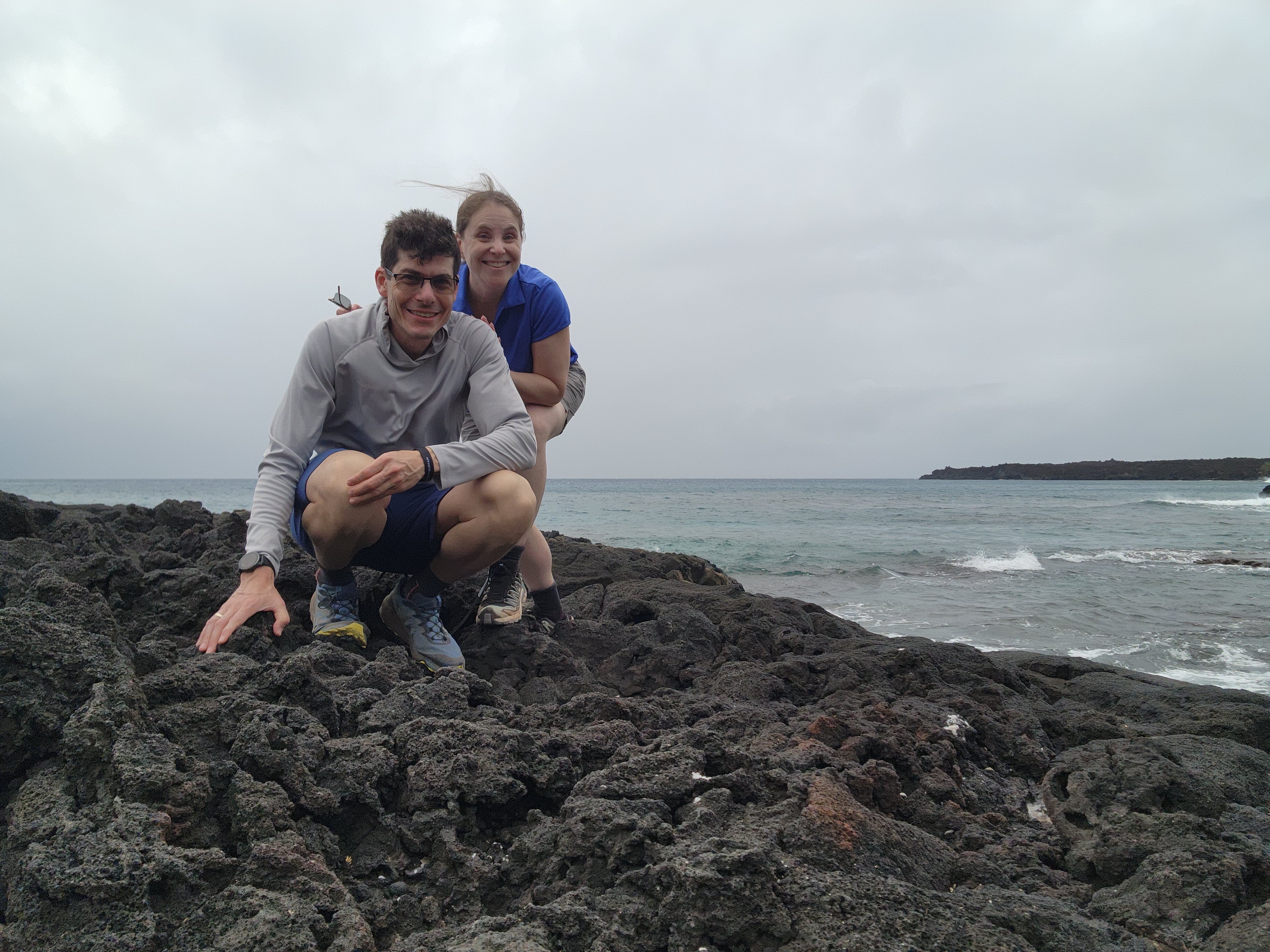
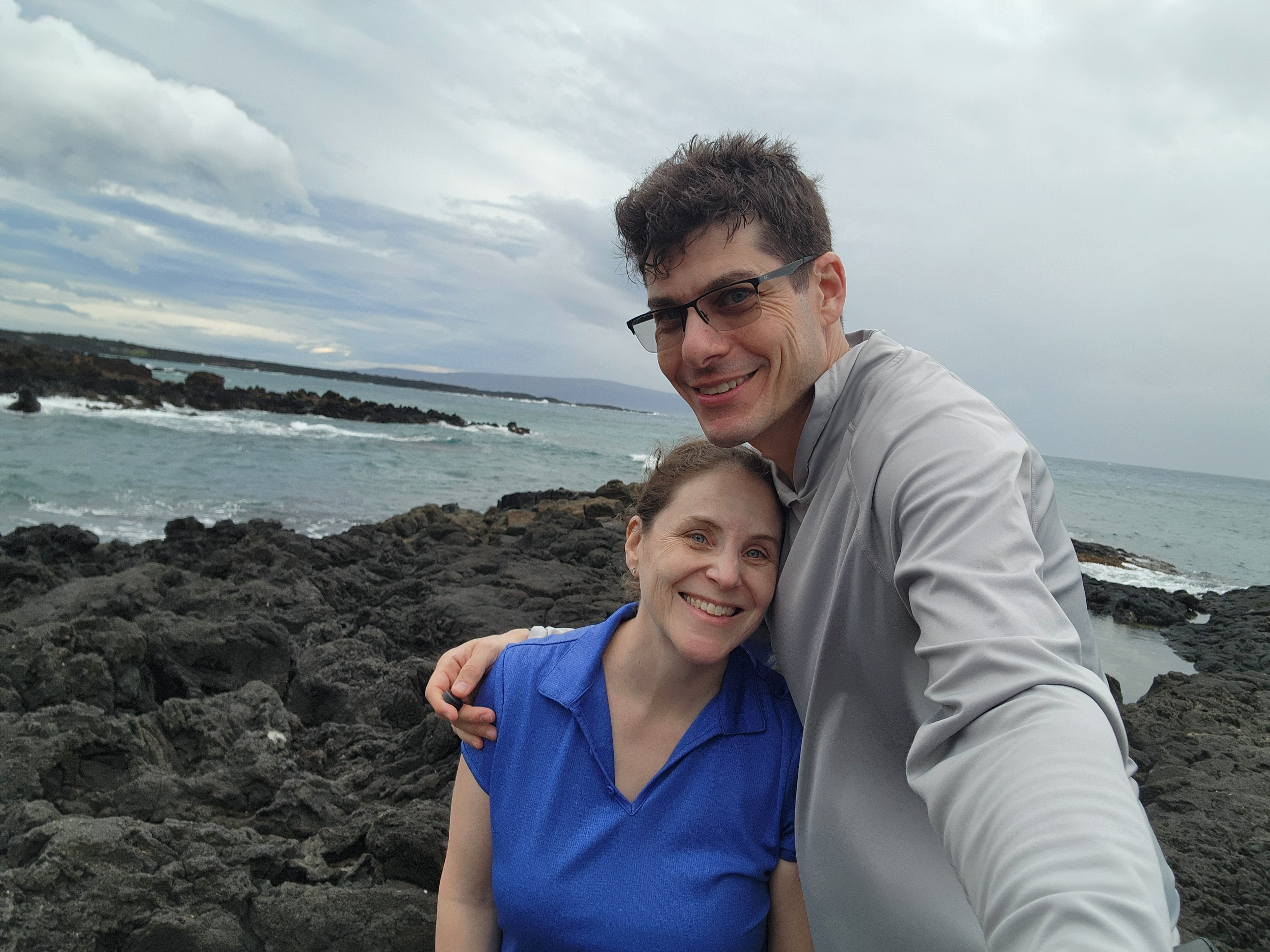
Getting there meant a drive to the literal end of the road: Makena Alanui Road runs south past La Pérouse Bay until the pavement gives up, and you park. From there, you'll find the trail head for the Hanomanioa Light Trail, which doubles as the approach to the Hoapili Trail — that old King's Highway — brown sign number two. The second half of the Light Trail overlaps the Hoapili Trail, so chasing a lighthouse comes with the privilege of setting foot on a royal road laid down five centuries ago (more on that below). The path is well-marked the whole way and hugs the shoreline, with open-ocean views at nearly every step. Spoiler: we never reached the lighthouse.
Terrain: the rocky road ahead
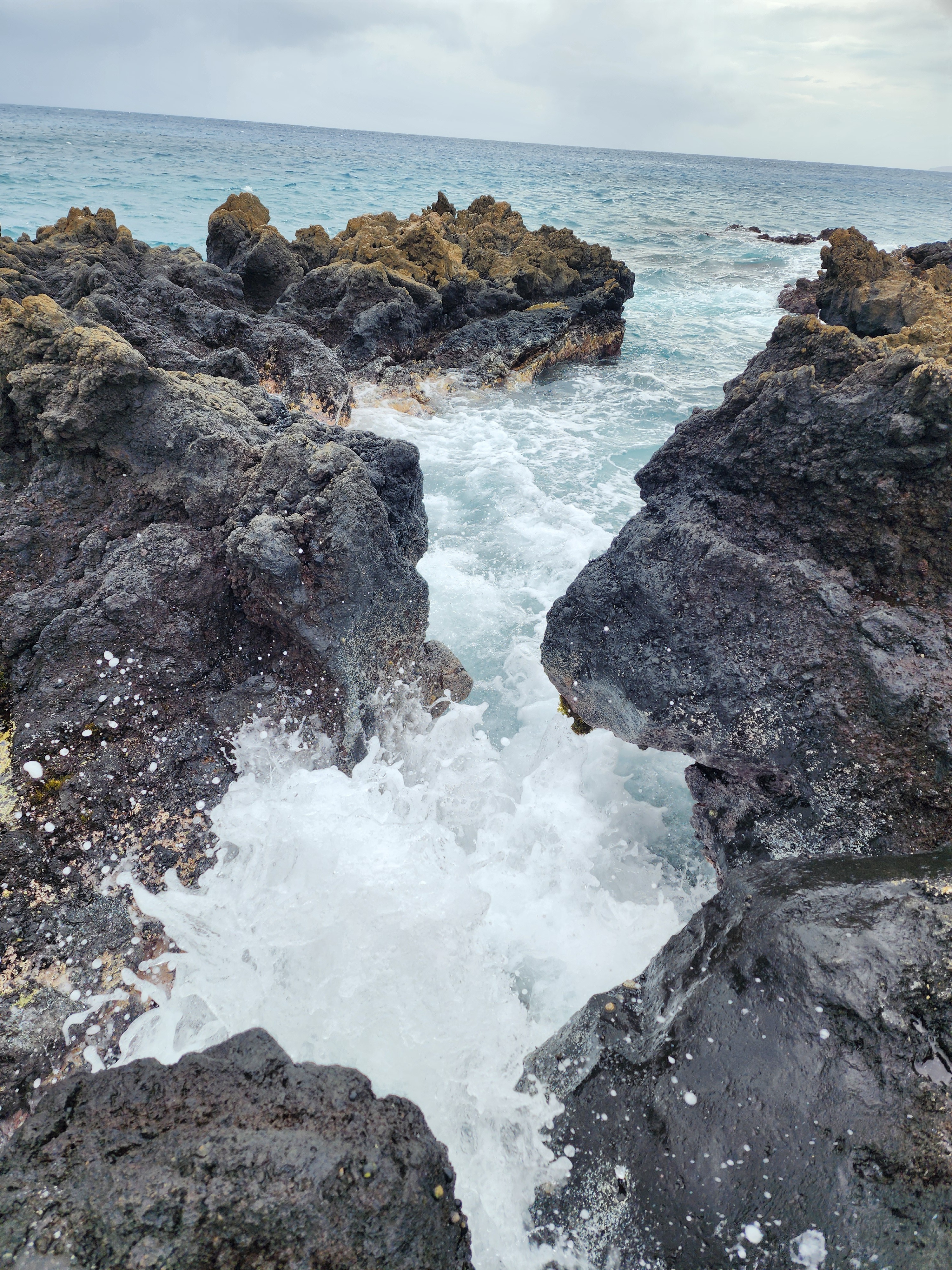
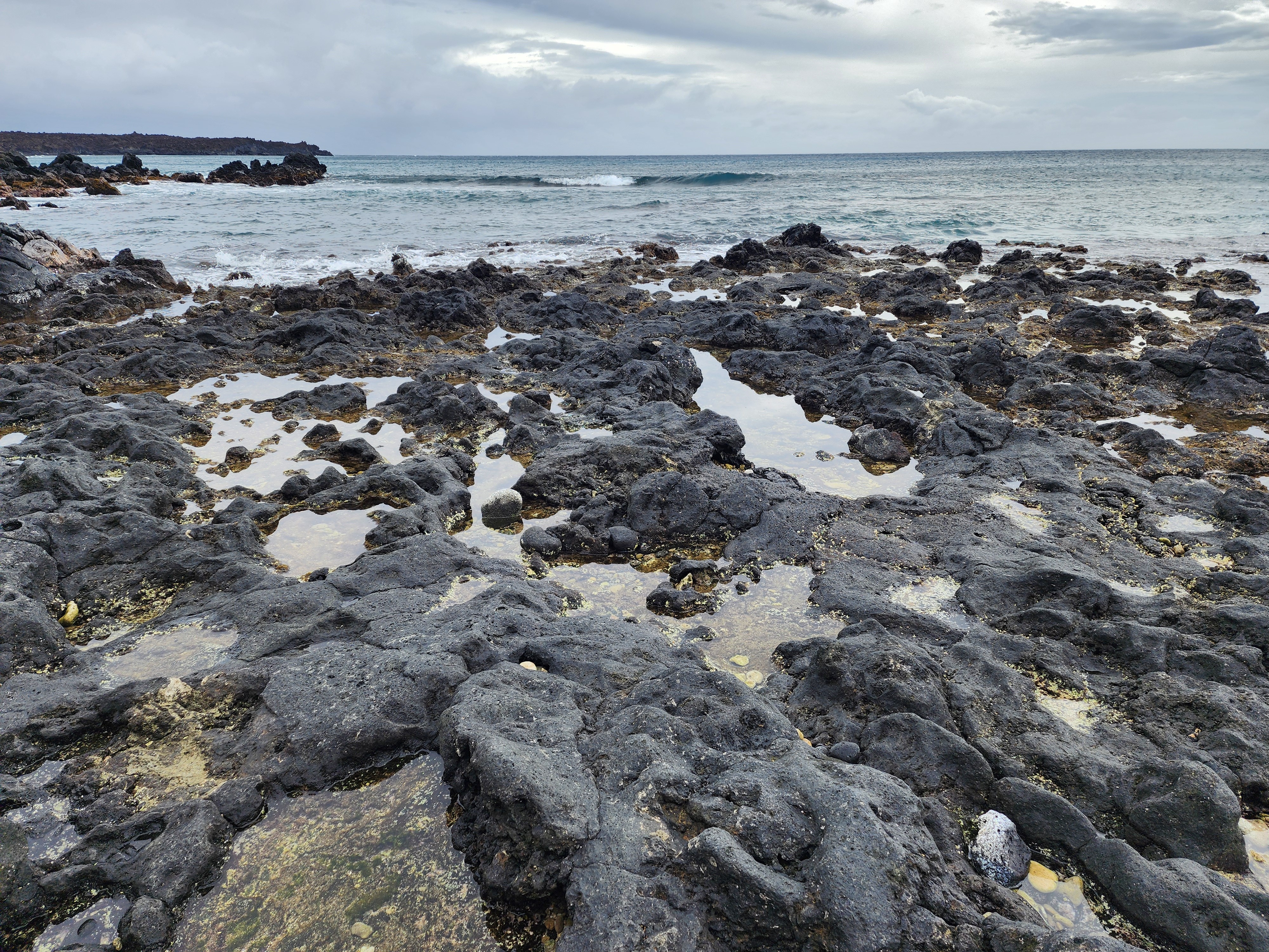
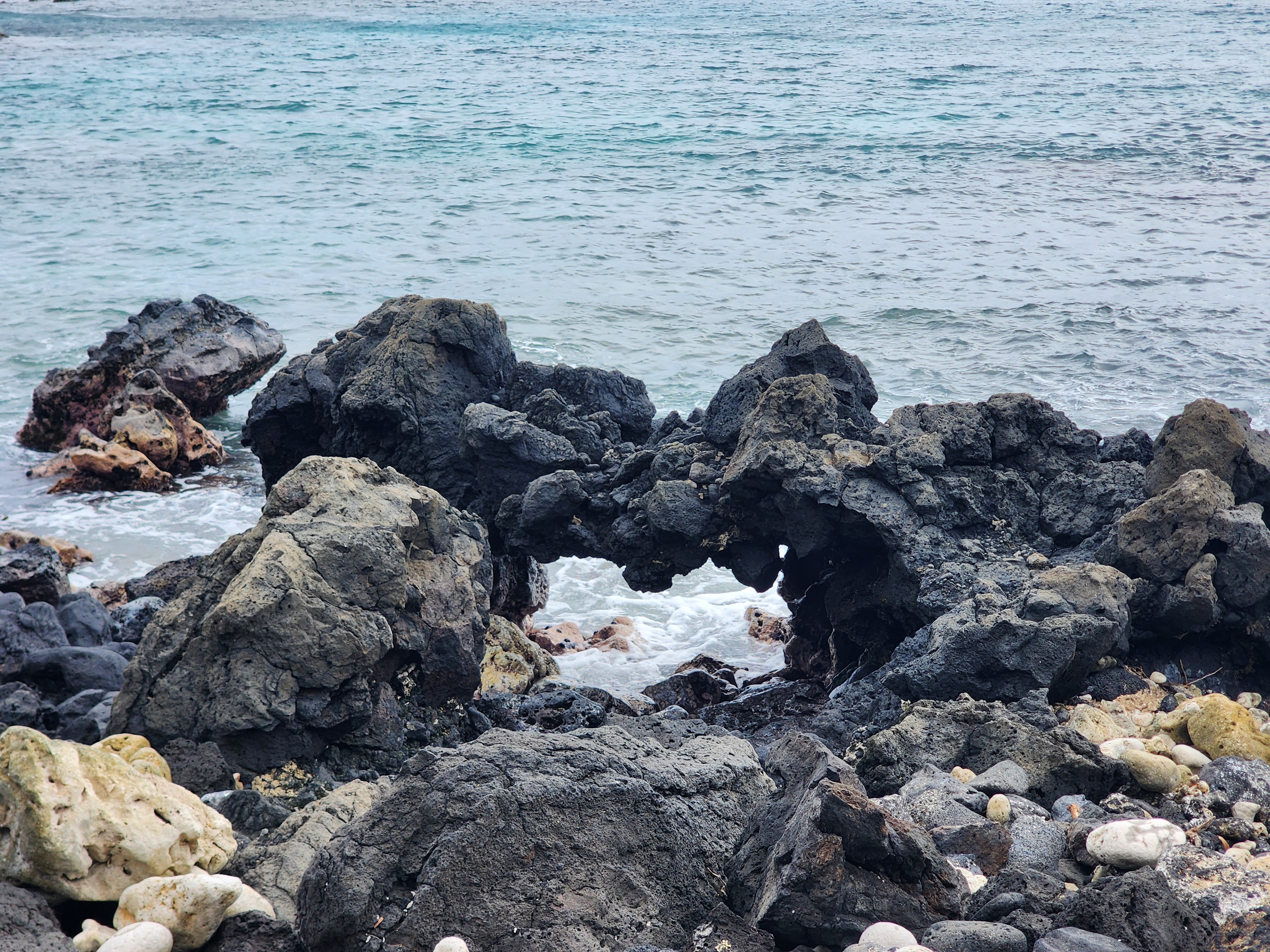
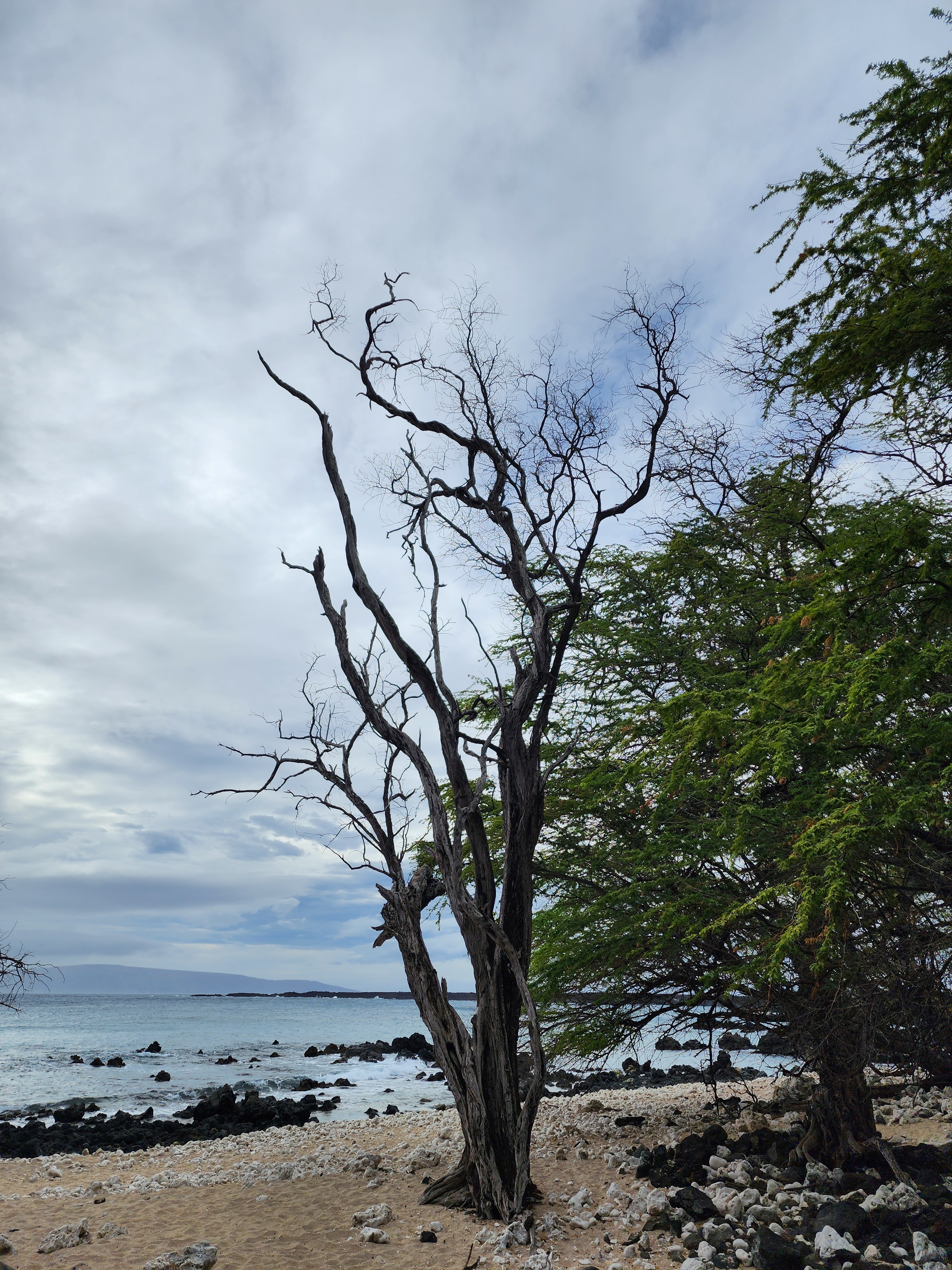
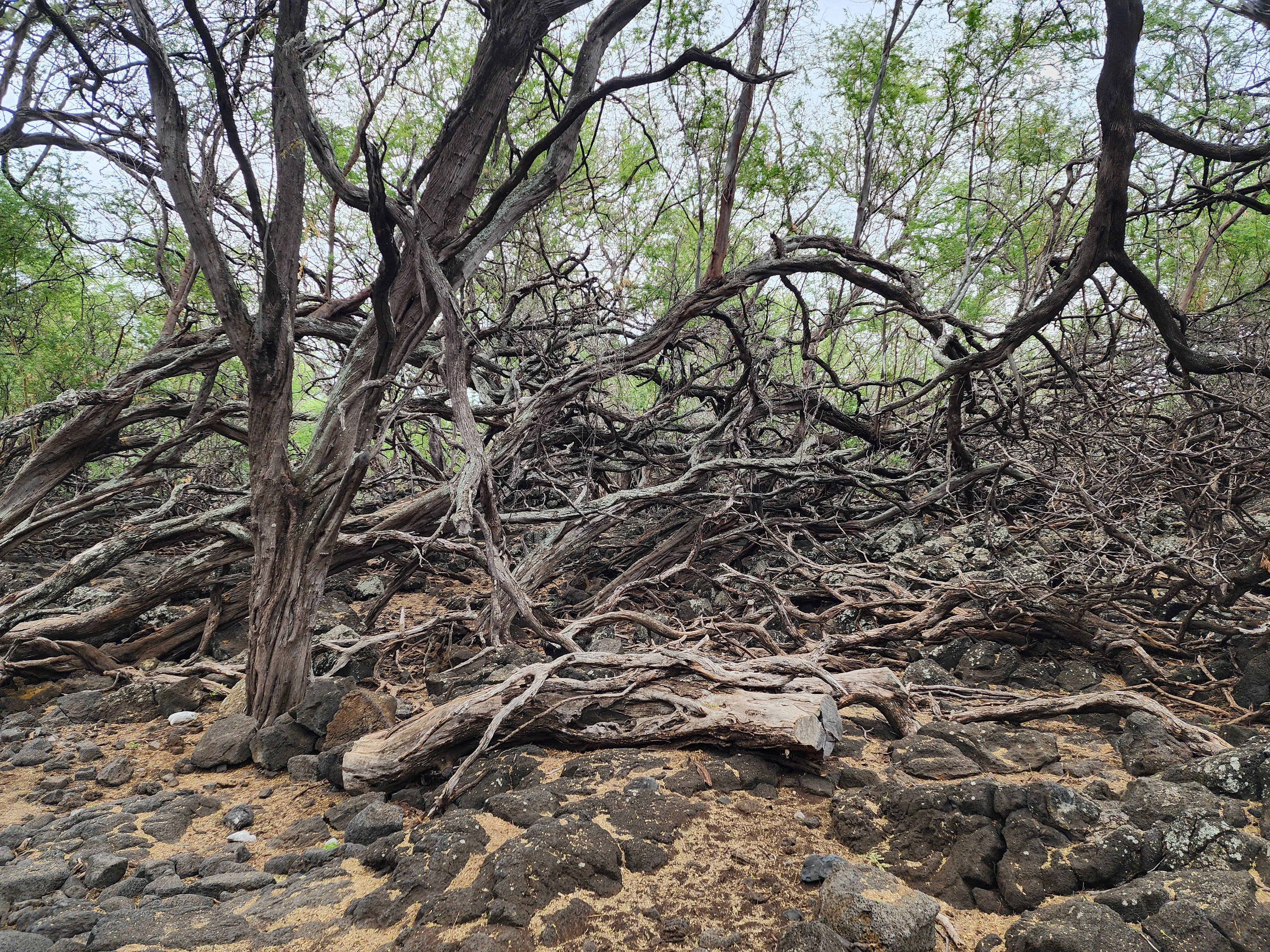
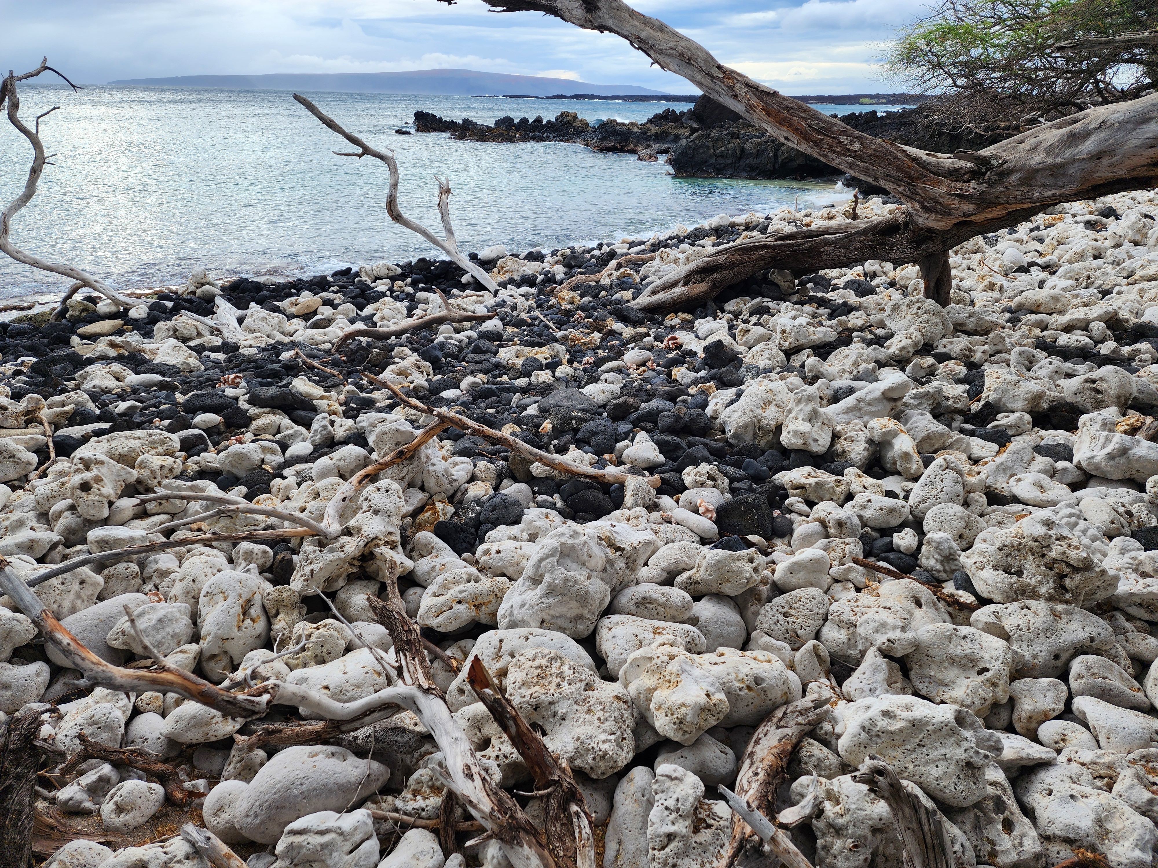
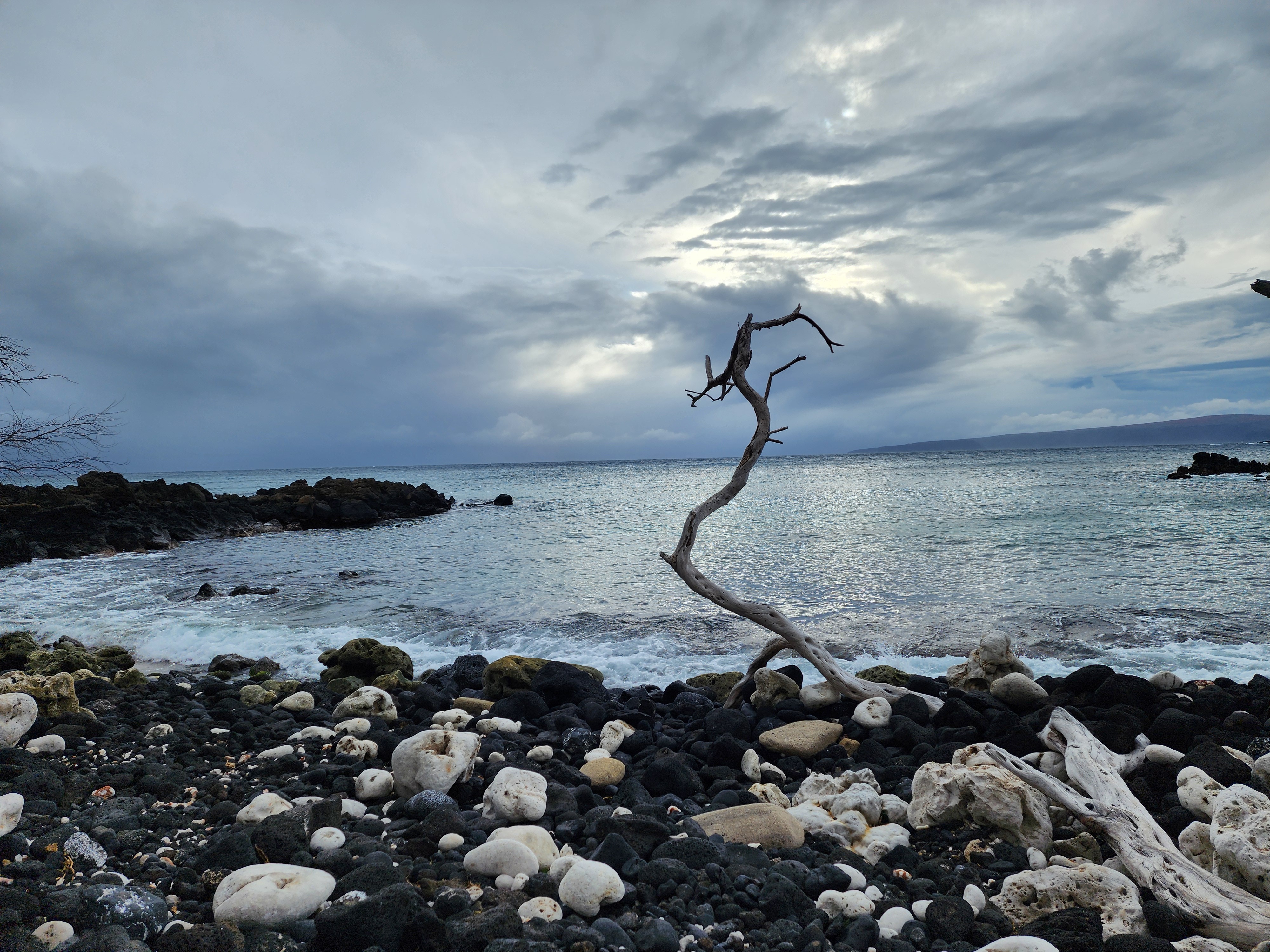
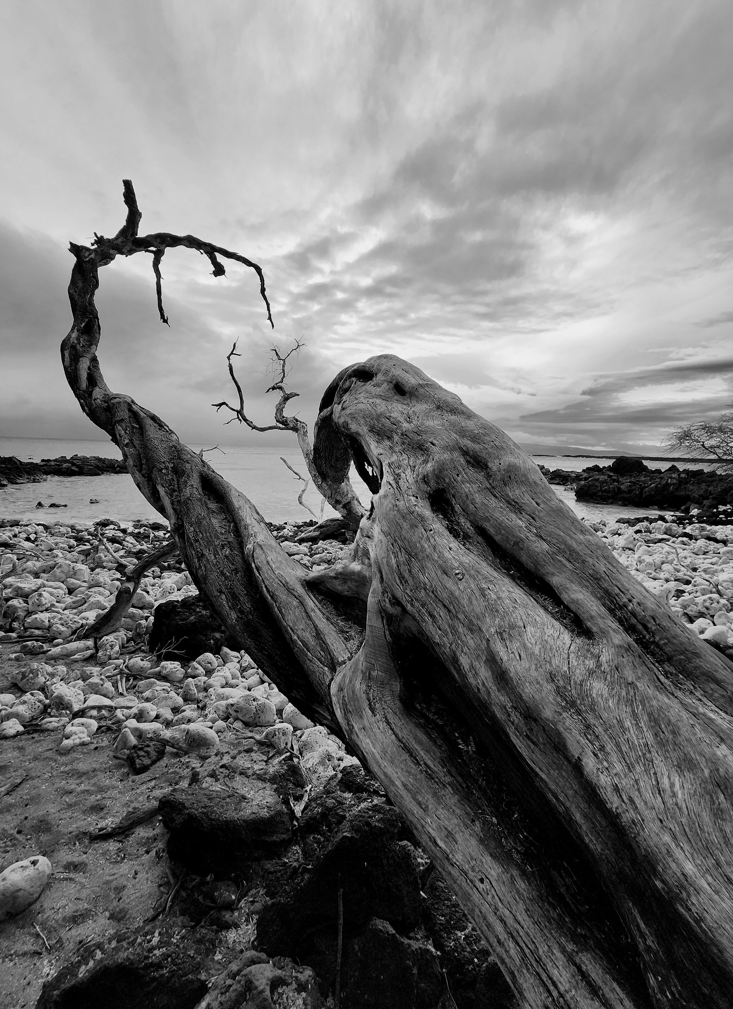
The footing is the first thing you notice. The trail starts over stark black lava rock, the path threading between the shoreline and the lava flow, with the occasional pocket beach breaking up the trail. It's raw and gorgeous and not remotely gentle — so pro tip: wear closed-toed, sturdy shoes. We wore trail runners and were perfectly happy. Oh, and don't forget the hat and sunscreen; the same overcast day that made our beach visit earlier in the day feel forced almost certainly saved us from heatstroke out on the black rock.
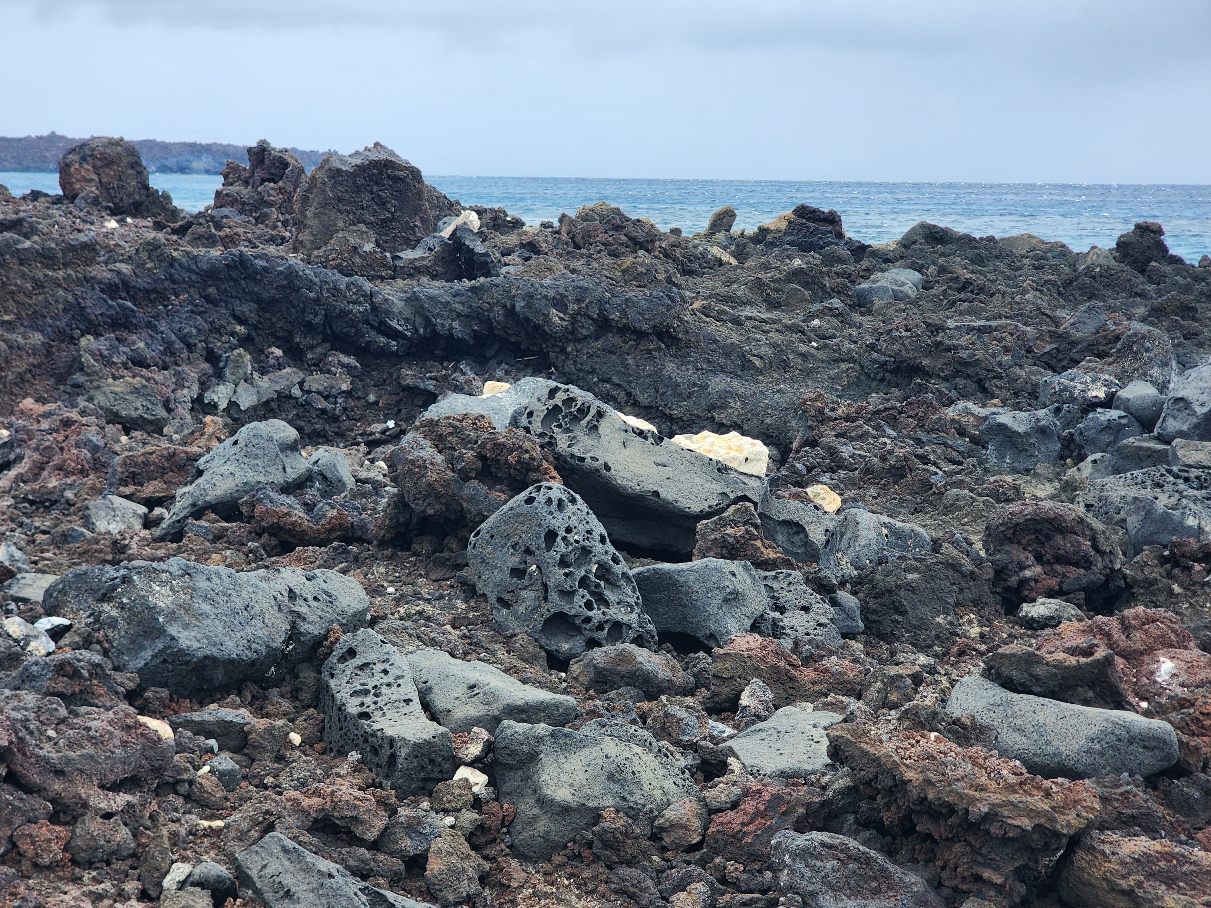
One of the first questions I had out there was: how old is this lava we're wandering over? Ten years? Ten thousand? You'd think, in the age of GPS satellites and carbon dating, we'd know. We don't — and there are three serious answers, none of which agree.
Ask Hawaiian oral tradition and you get one number: accounts collected in 1841 had people saying their grandparents watched this flow happen — which points to roughly A.D. 1750. Ask the European charts and you get another: the flow shows up somewhere between La Pérouse's 1786 survey and Vancouver's 1793 one, which is where the popular "1790" date comes from. Ask the laboratory — radiocarbon dating, calibrated, plus paleomagnetic work — and you get a third answer entirely: somewhere around A.D. 1480 to 1600, two or three centuries earlier than the signs claim.
What I love is that this isn't a "science versus myth" story. All three are real, careful attempts to answer the same question, and the USGS itself takes the oral history seriously, noting that it "is important and not to be overlooked among the numbers from laboratories." We were standing on the evidence of an obviously dramatic event, in the era of science, and the honest answer to "when did this happen?" is still: nobody's quite sure.
History: the village that was here
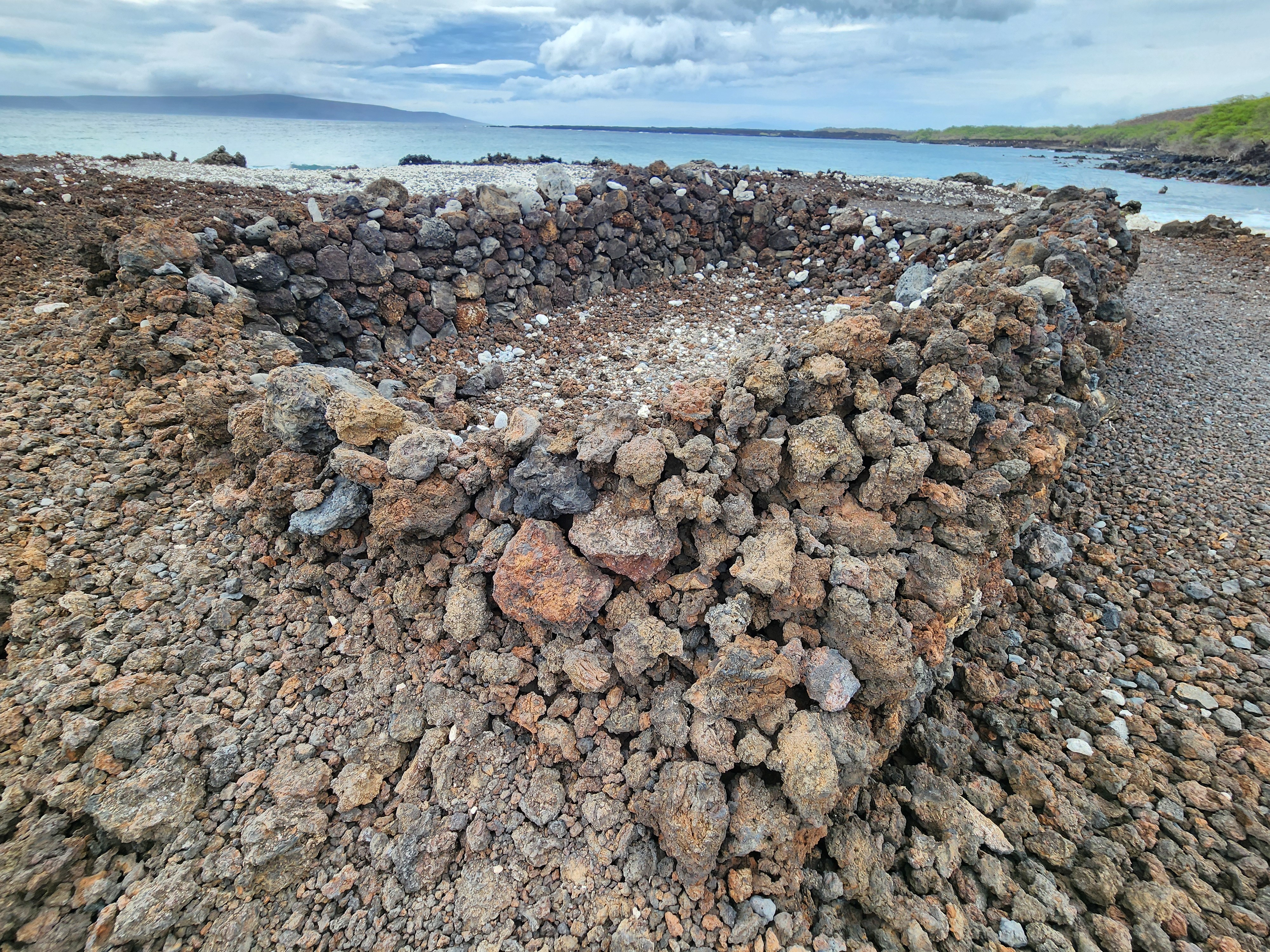
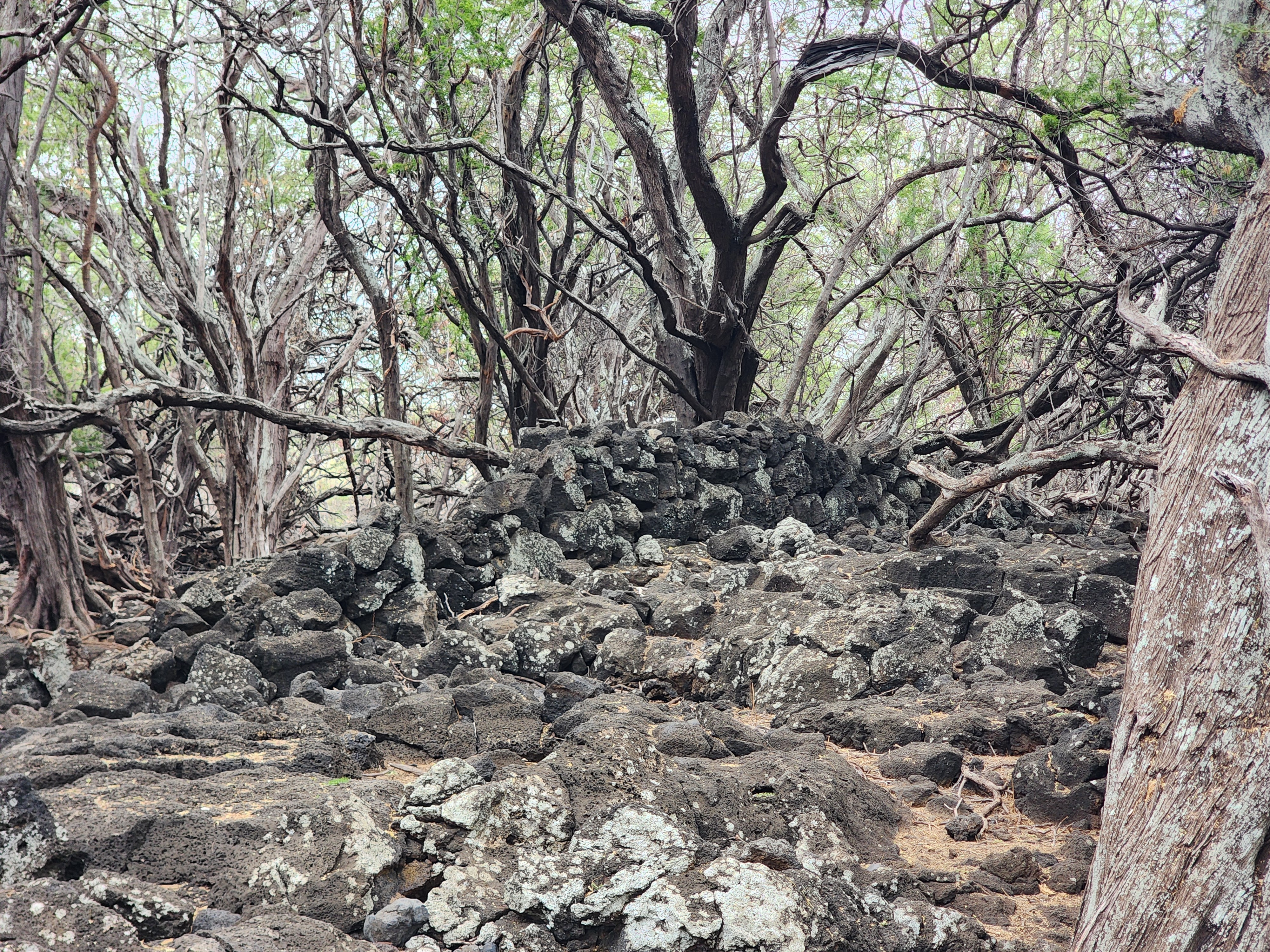
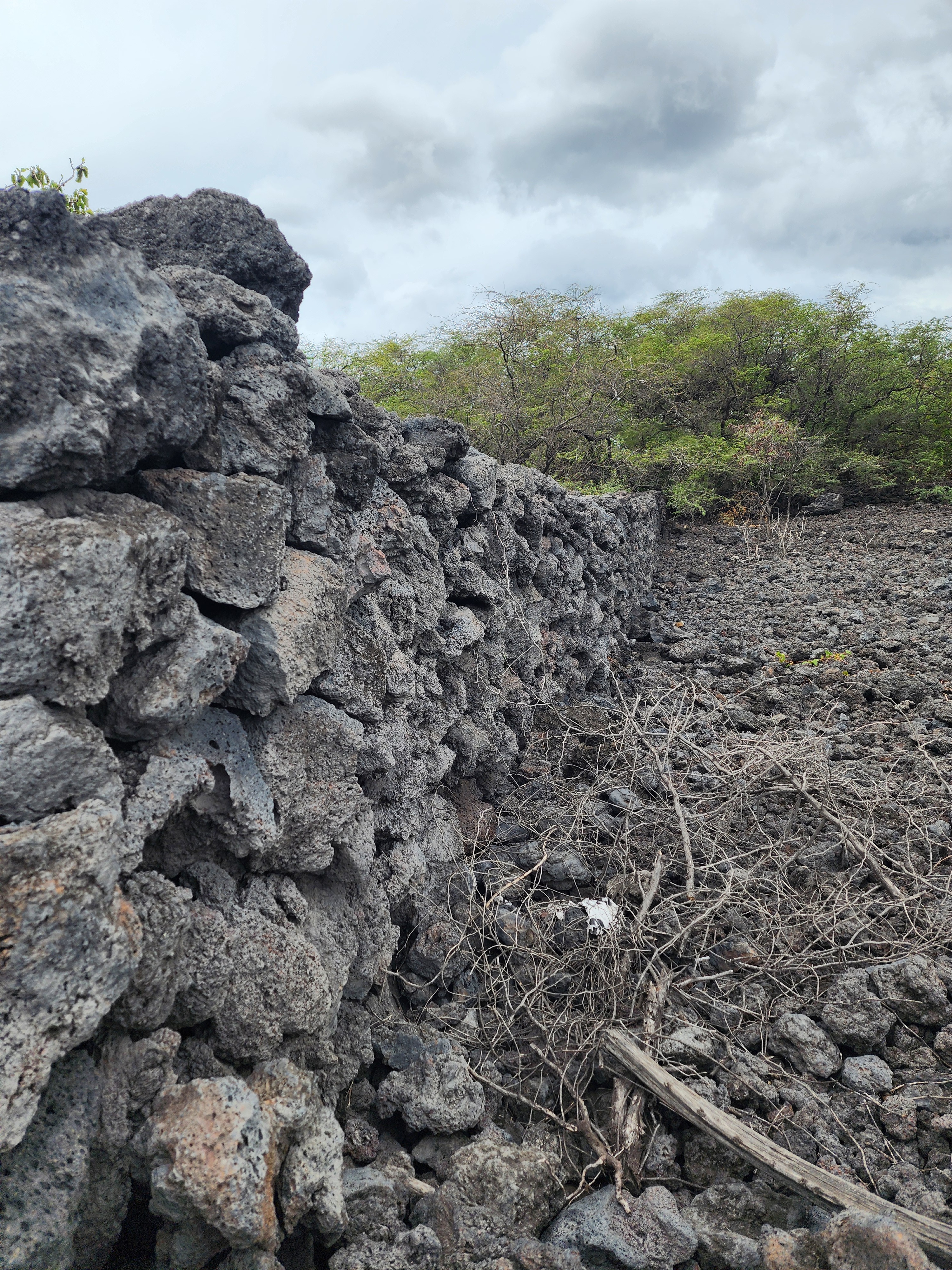
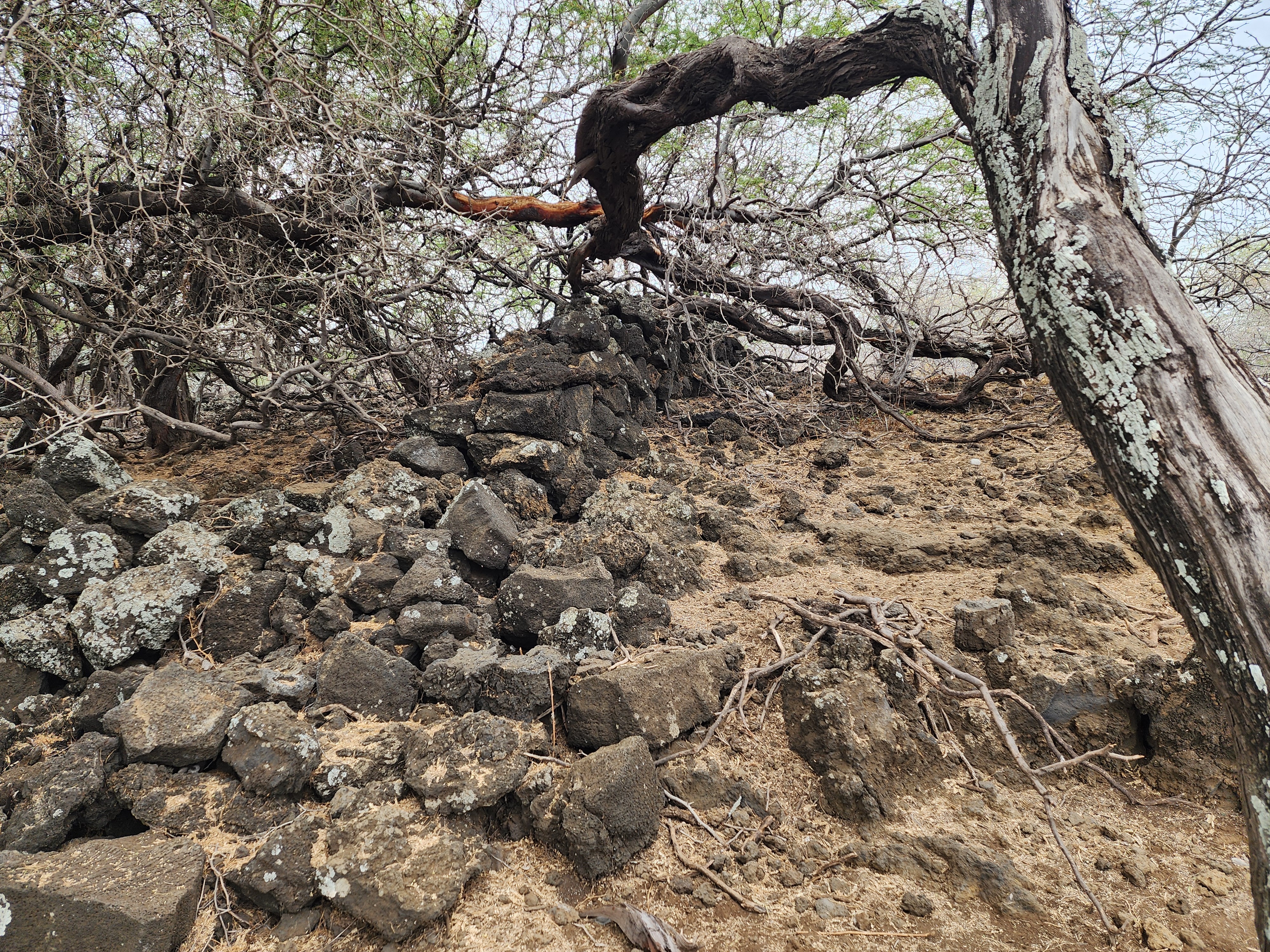
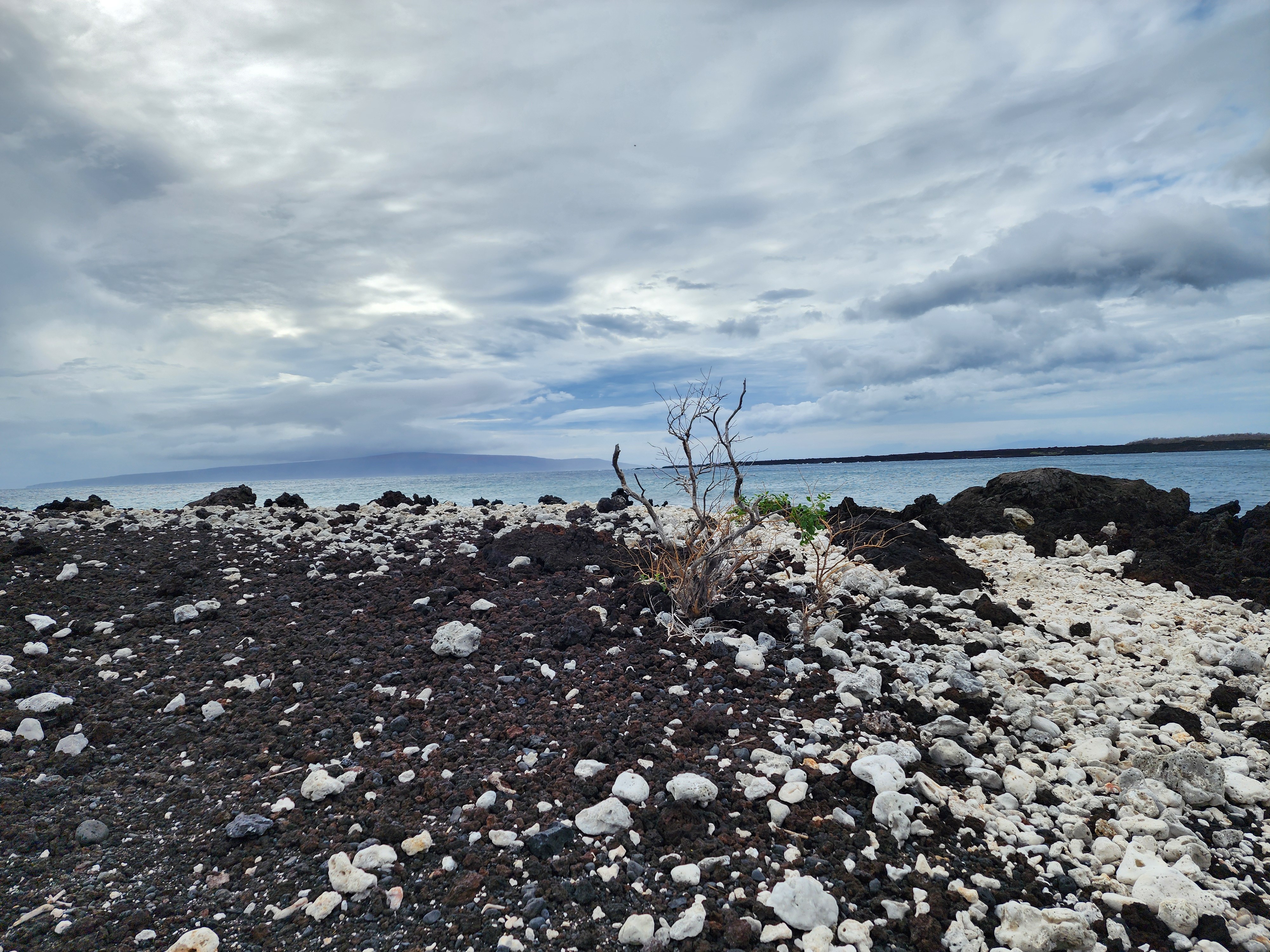
As you walk, you start seeing it. Lava rock carefully arranged. Is that a wall? The remnant of a house? Ooh, maybe a platform for religious ceremonies? Every time I saw this obvious order, I had the same question: what am I looking at? Alas, there's no placard, no sign, no QR code to scan. Nothing to tell you.
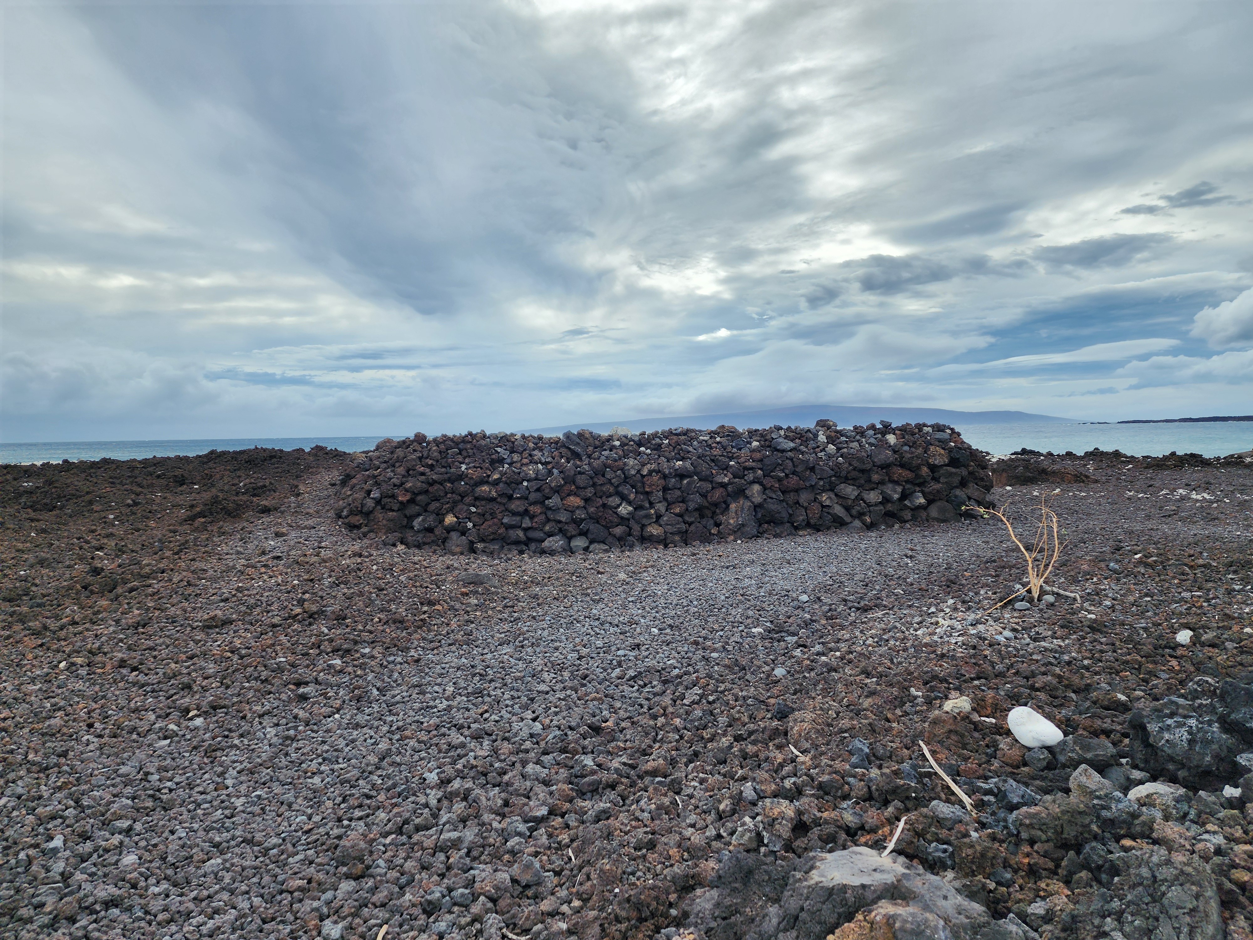
What's up with this? Are these not of archaeological value? Maybe it's just local teens goofing around, stacking stones. Or maybe it's some grand mystery: Babe, we just found Hawaii's Stonehenge. The signs told us this was a historic location — so maybe the rock structures themselves are the puzzle.
A bit of research put these theories to rest. There were no signs, but plenty of answers. This stretch of coast is Keoneʻōʻio, and the rocks aren't random. They're the stone bones of a Hawaiian settlement — house foundations, fishing shrines, salt pans. Even the clusters that puzzled me have a name: kauhale, the Hawaiian household, which wasn't a single building but several, each with its own purpose. One reason for the sprawl: under the ʻai kapu, men and women ate in separate houses — a husband cooked two ovens, one for his wife and then one for himself in the men's eating house. It's kashrut meets the mechitza, ancient Hawaiian style. A home was a compound, and a compound leaves a lot of walls.
And here's the kicker. The man whose monument waits at the end of this hike — La Pérouse — walked this exact shore in 1786 and found it alive. In his journal the huts ran "along the seashore," so many that "one might mistake an area of three or four leagues for a single village," the people paddling out to trade "pigs, sweet potatoes, bananas, [and] taro." So when did that thriving place empty into the silent rubble I was stepping over? Maddeningly, the question loops right back to the rock. If the lava is as old as the science says, these are very likely the remains of the very village La Pérouse described, raised on stone that had cooled centuries earlier. If you believe the "1790" on the signs, the story turns darker and murkier. I can't settle it — the same unanswerable when? that hangs over the lava hangs over the ruins. I never got my placard, but I got plenty of answers.
The trail itself is the headline artifact. This is a remnant of the Alaloa o Kihapiilani — the King's Highway — first built in the 16th century under Piʻilani, the chief who unified Maui's districts. In its day it ran clear around the island, reserved for the aliʻi — Hawaiʻi's ruling chiefs. In the 1820s, Governor Hoapili rebuilt sections of it for horses and carts, which is how it got the name everyone uses today. He did it with convict road gangs — many of them sentenced for adultery — which earned the project its nickname, the road that sin built. So you're walking a royal road, cut by a lava flow, rebuilt by a governor, and now reclaimed by the wind — layers of time stacked under your boots.
Wildlife: feral and wild, both hiding in plain sight
Two creatures stood out this trip. One is a story about people. The other is, no exaggeration, one of the toughest animals on the planet.
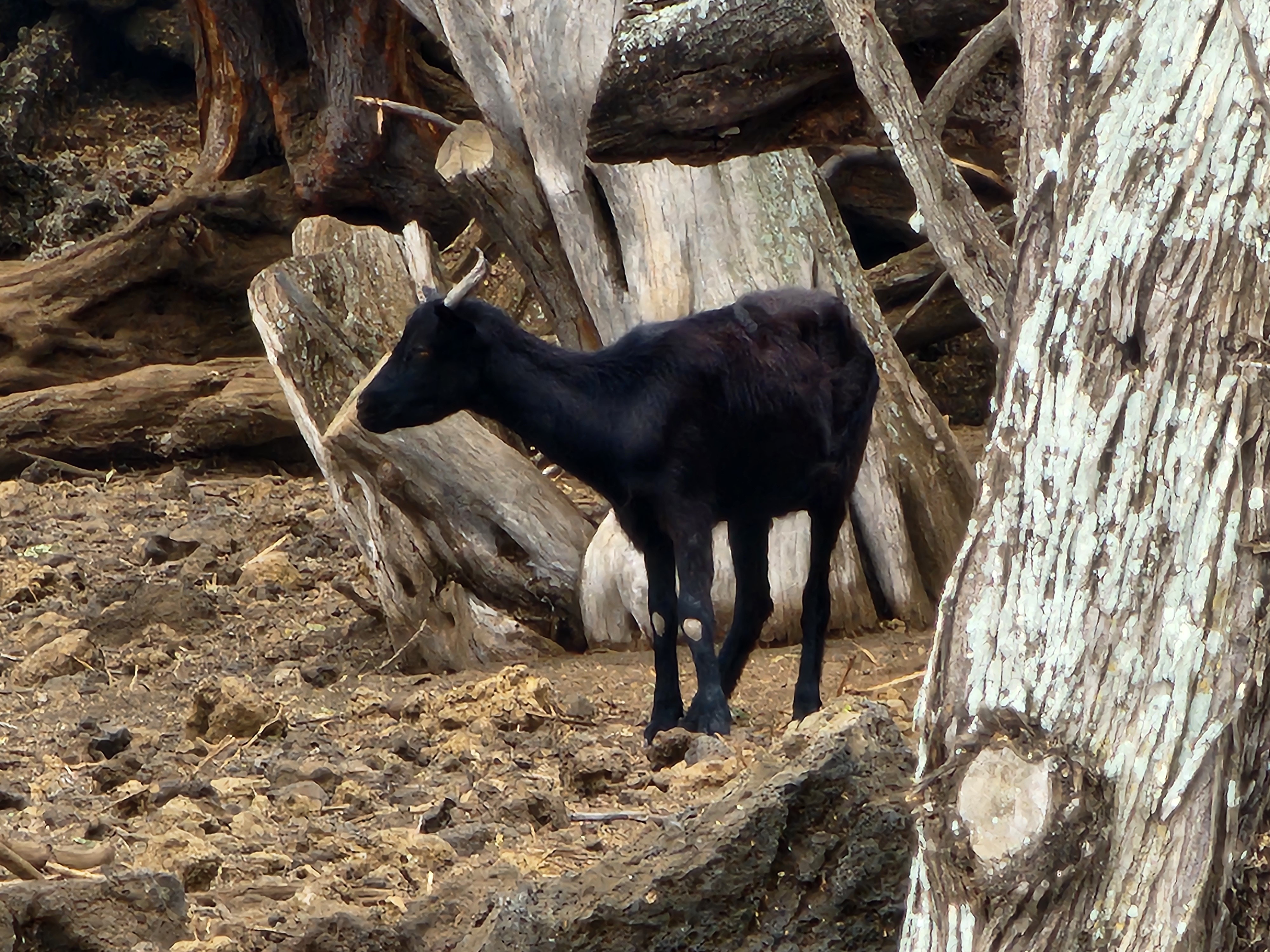
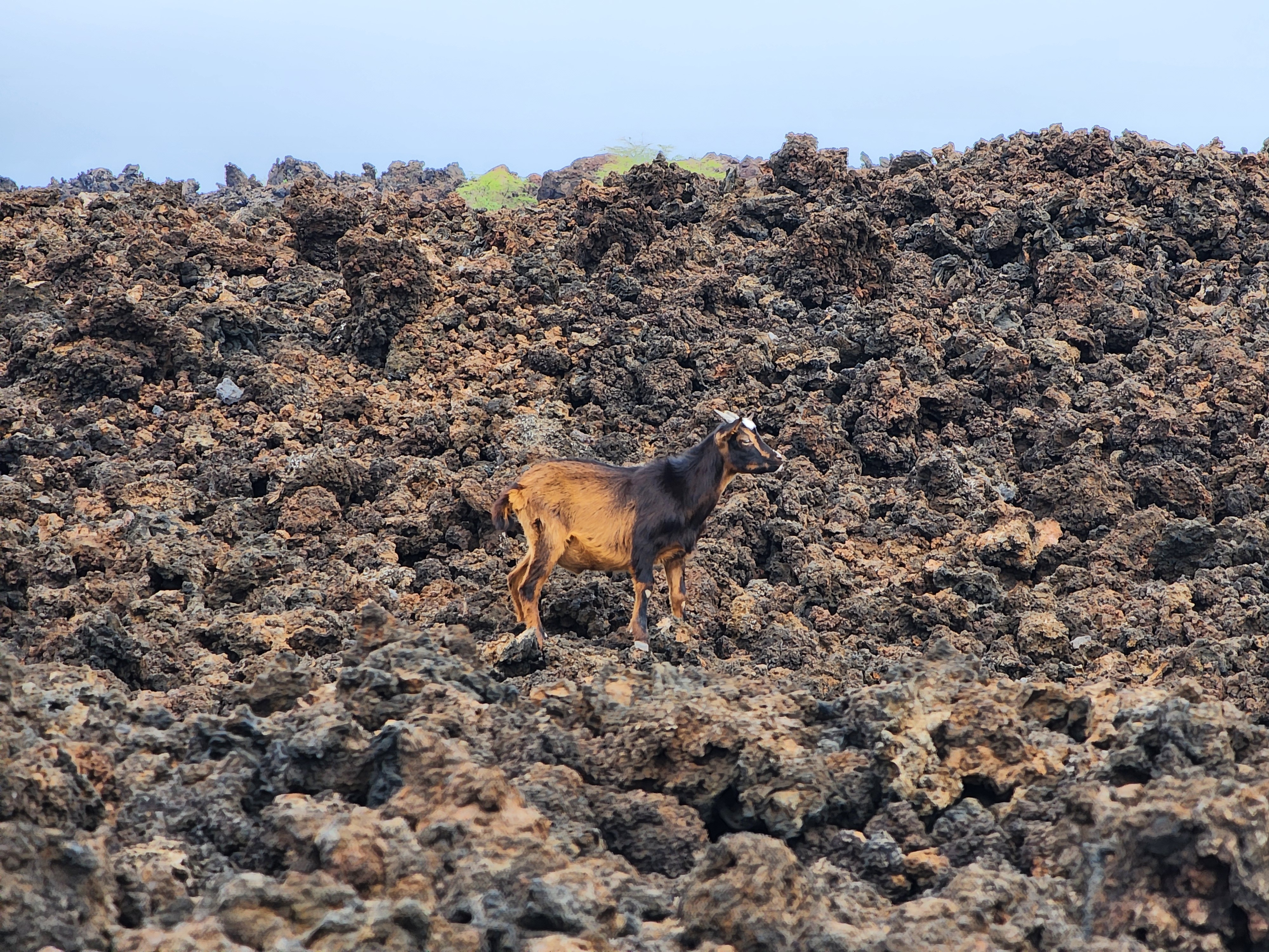
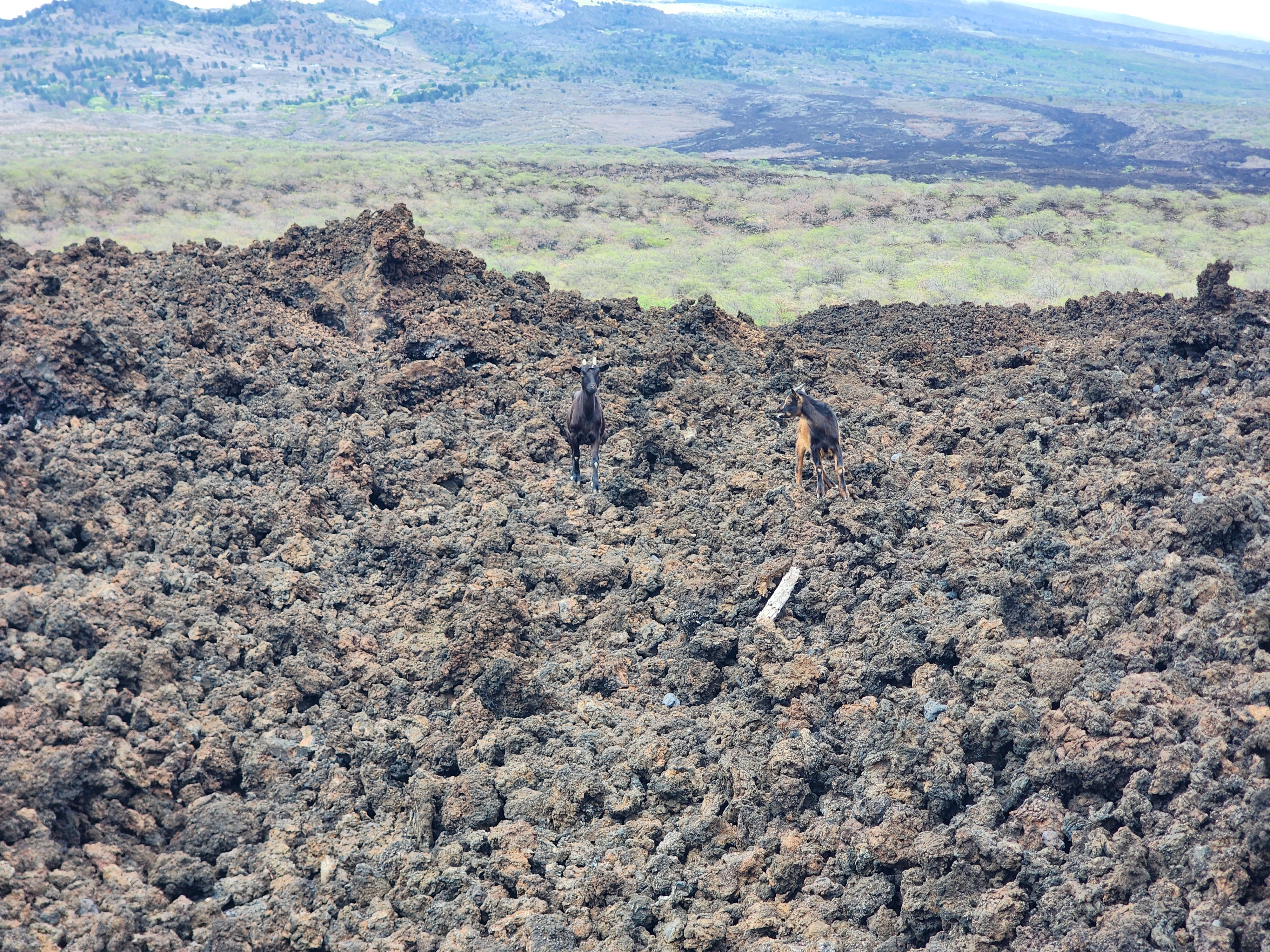
First, the goats. I had no idea they were coming — we rounded a stretch of trail and there they were, picking their way across the lava. My instinct was that they weren't wild — somebody's animals, surely, ranging out from a farm. I even gave them a job: aren't goats basically a low-tech lawnmowing service? Wrong.
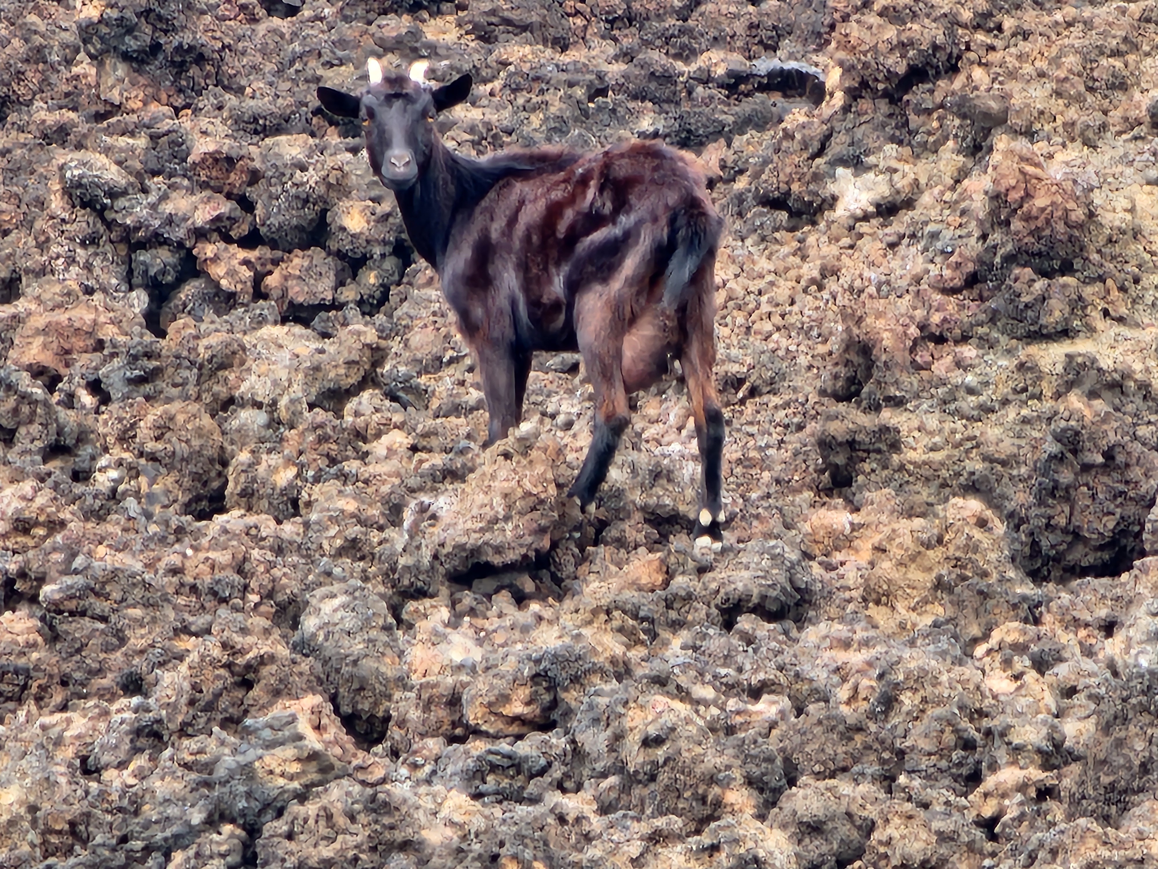
They're neither pets nor wild natives. They're feral, and the backstory is colonial. Goats first came ashore with Captain Cook in 1778, with more added over the following decades. With no predators and a breeding cycle that runs to two sets of twins a year, they did what goats do — today feral goats rank among the most destructive introduced herbivores in the islands. The ones picking across the lava in front of us were, in all likelihood, descendants of those first shipboard arrivals. That's what stuck with me: not an invasive-species statistic so much as living history — the still-unspooling aftermath of a decision made on a deck in the 1700s.
And then there's the animal that caught my eye in the moment, yet has a story that goes far beyond what I imagined.
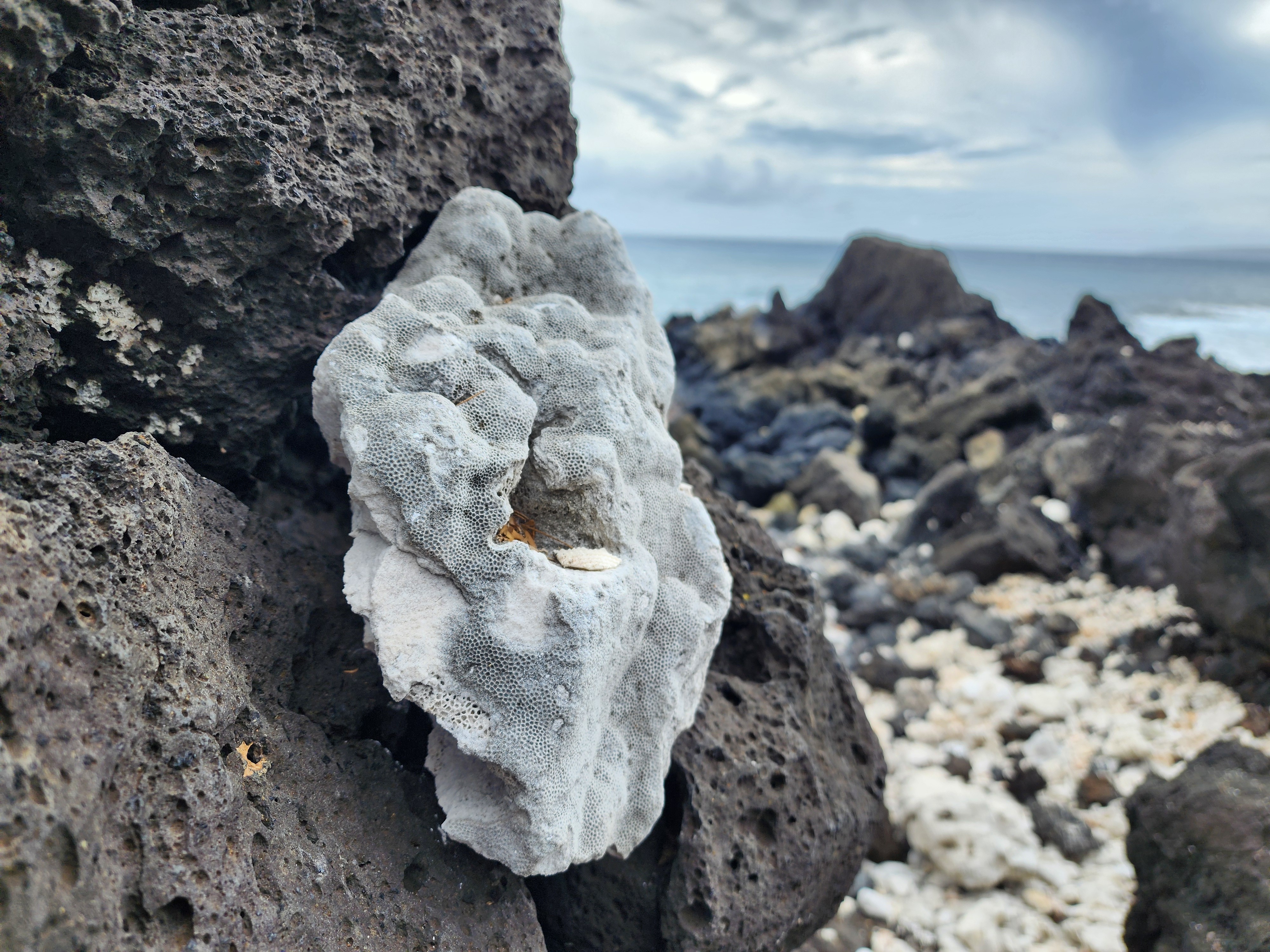
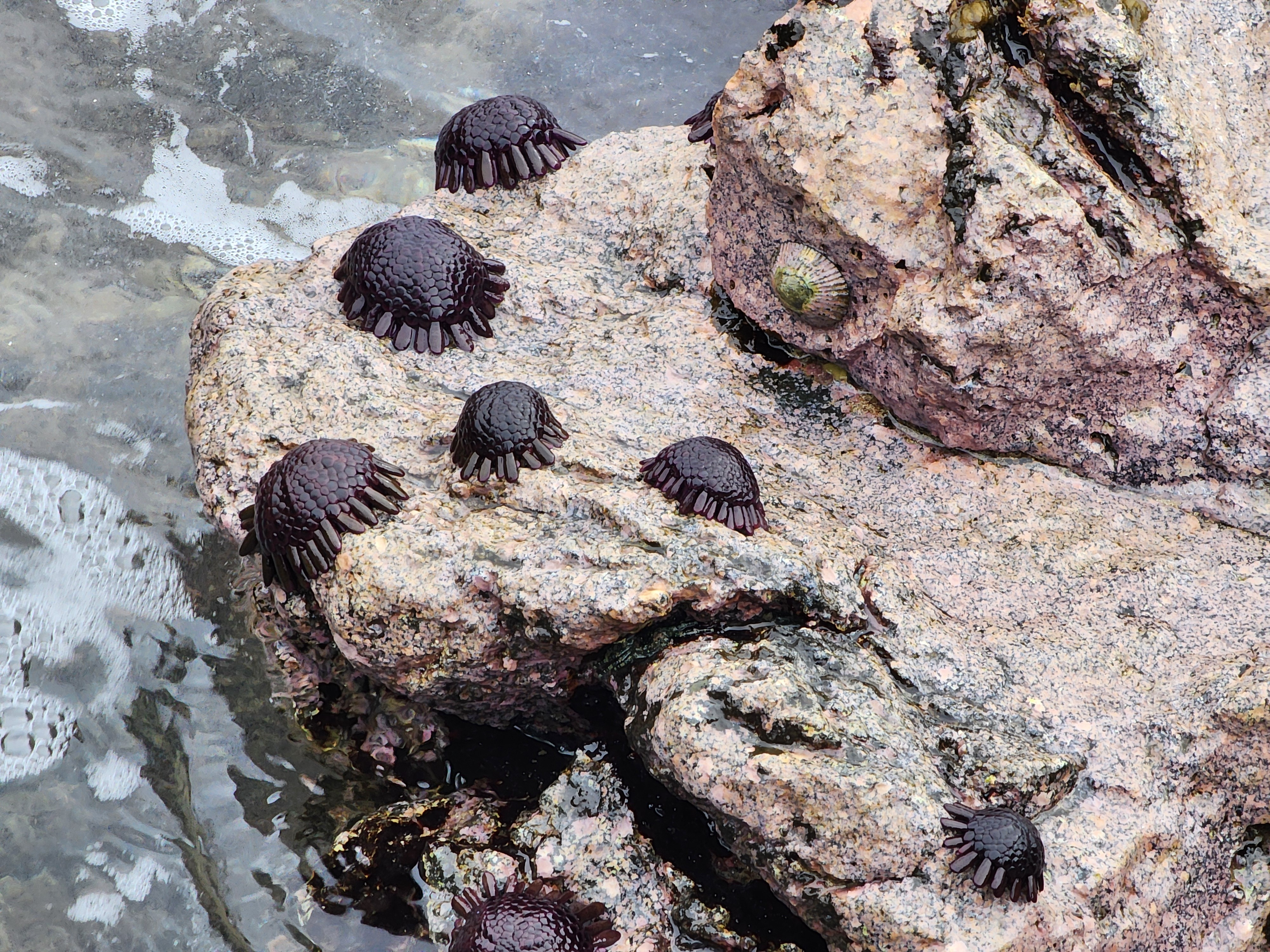
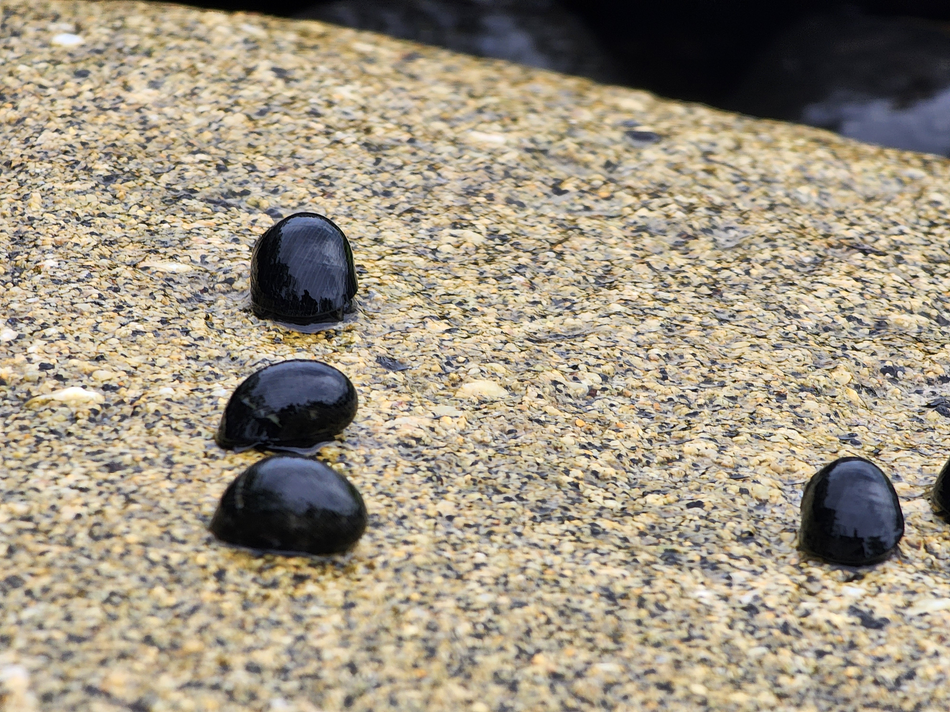
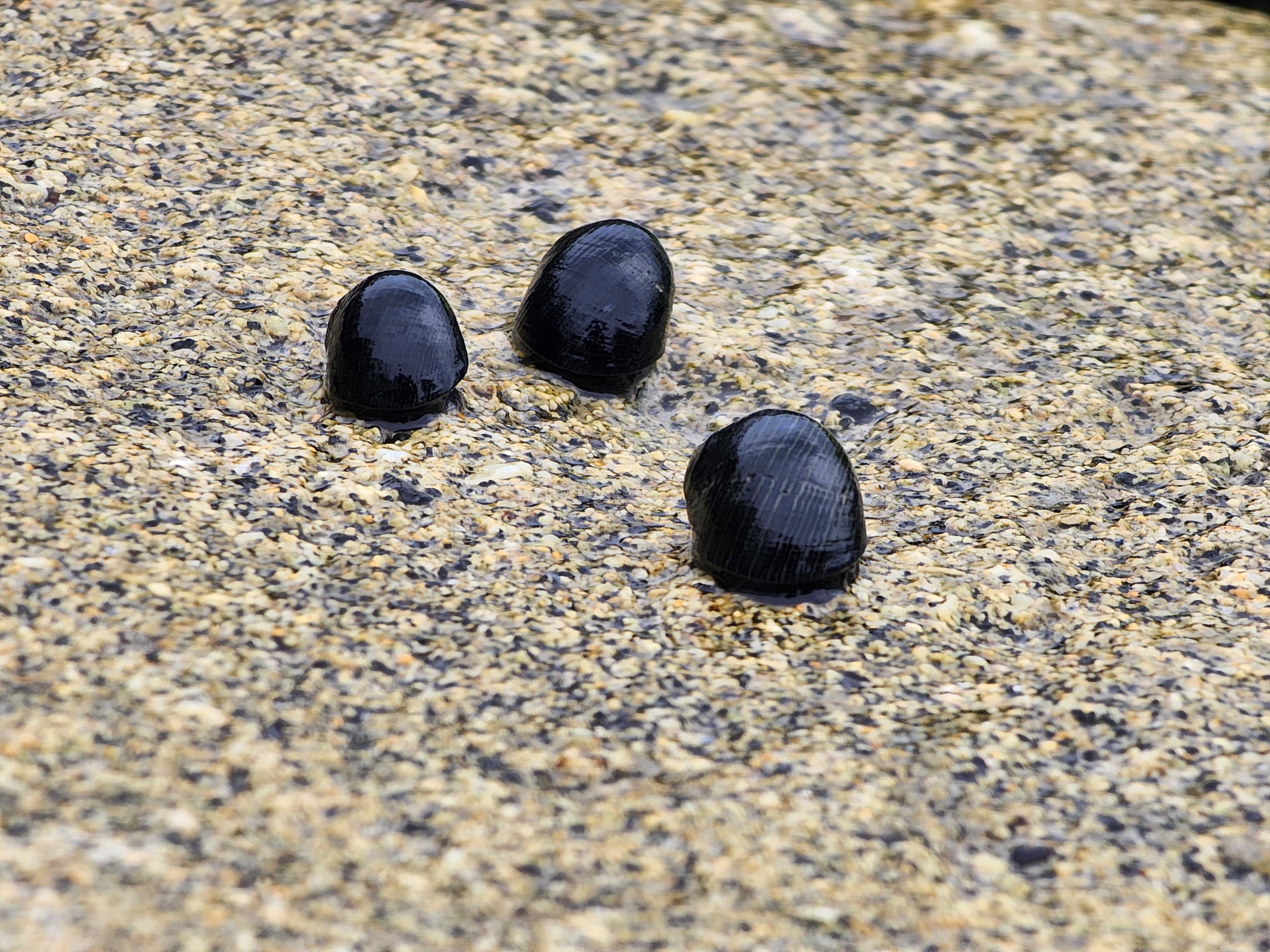
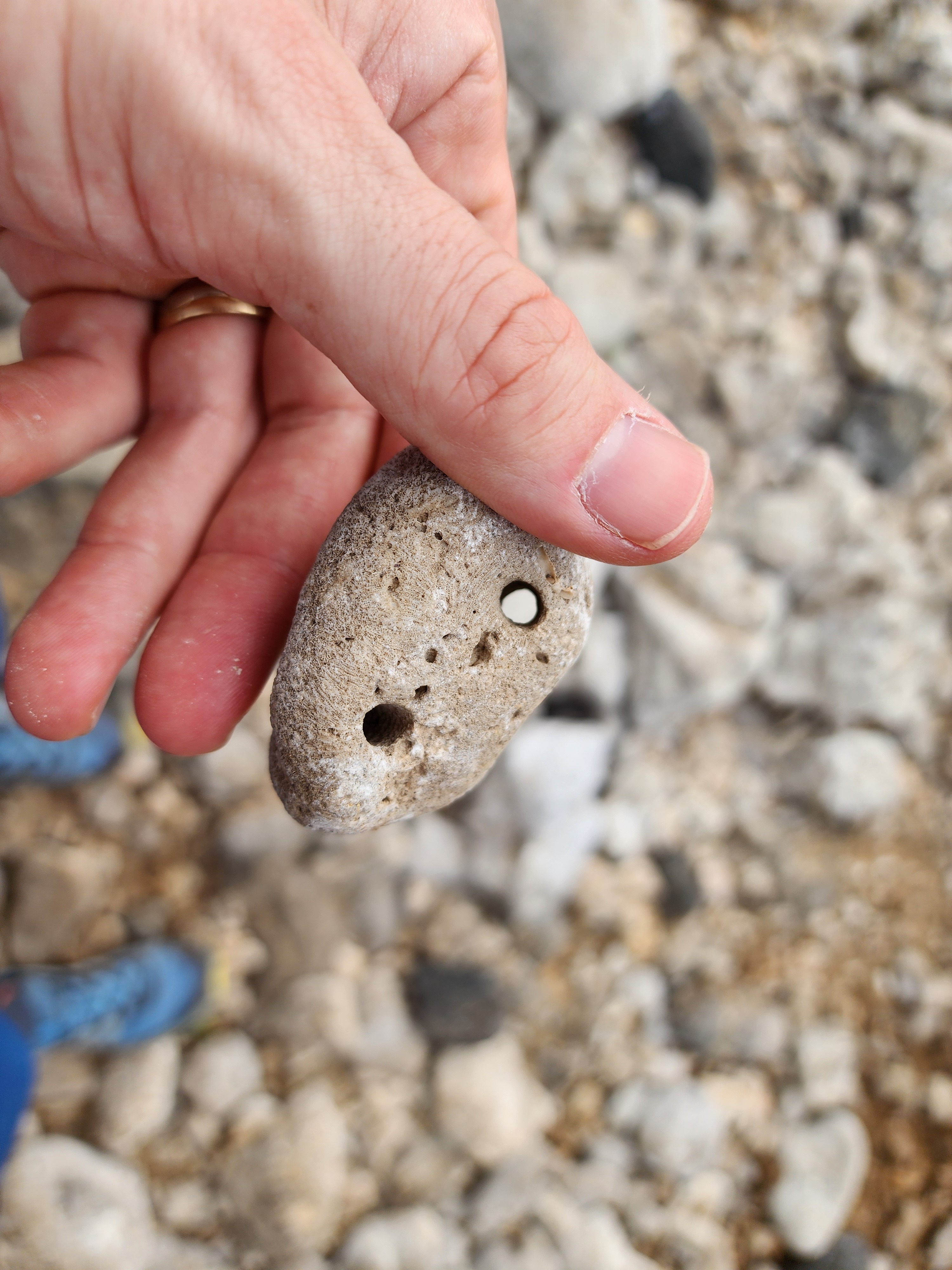
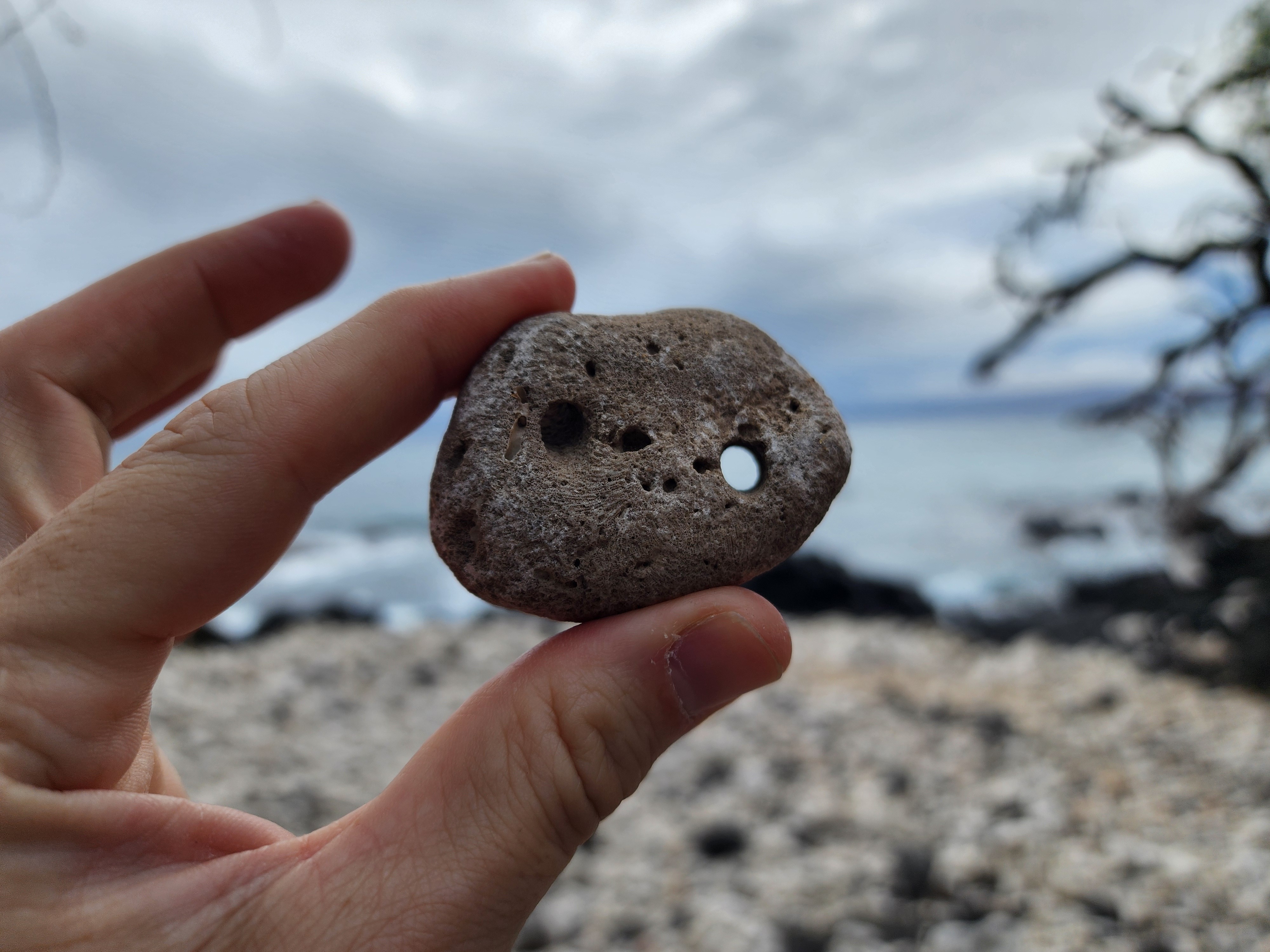
Down at the waterline, clamped to the rocks in the spot where the waves hit hardest, were dark, low, dome-shaped little creatures. I gave them a glance and a guess: limpets. I thought back to the survival TV shows where contestants harvest and eat these easy-to-collect shellfish. Turns out the eating part was right; the identification was way off.
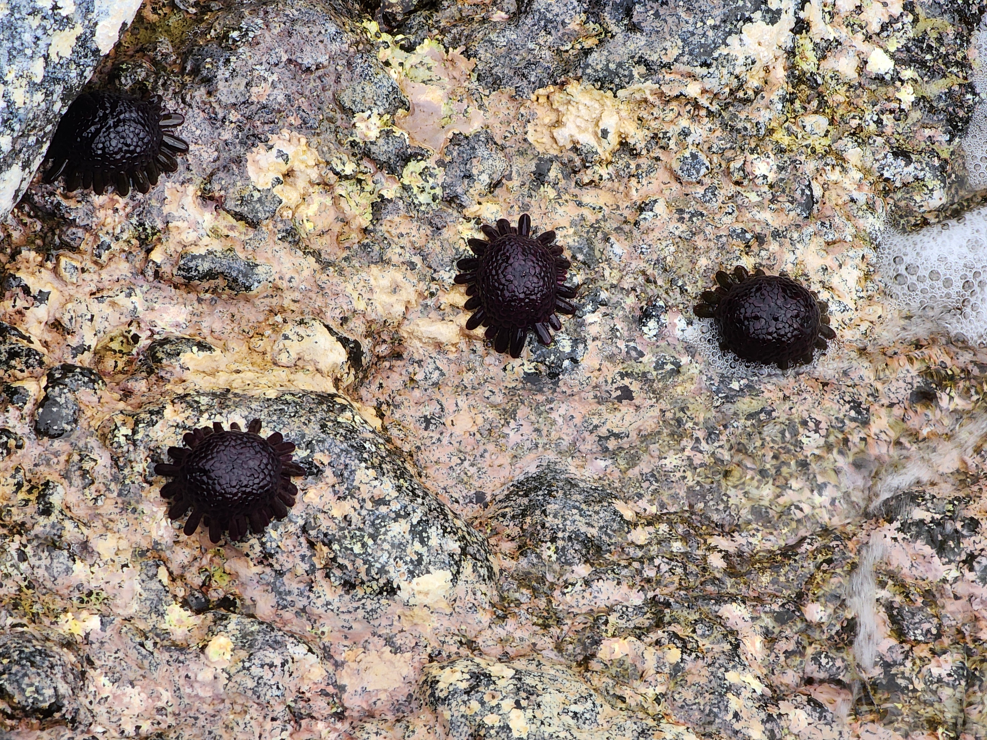
It's not a limpet at all. It's a sea urchin — the helmet urchin, or hāʻukeʻuke (Colobocentrotus atratus). What looks like a smooth tiled dome is actually its spines, flattened and fused into armor plating. In my defense, when I think sea urchin, I think spiny critter on the sea floor, ready to pierce your foot with its medieval — yet effective — defense system. These take sea-urchining to a whole new level. Their superpower: this thing lives in the single most violent real estate on the whole shore, the wave-impact zone where almost nothing else can hold on. It resists being torn off at water speeds up to about 27.5 meters per second — a gale strong enough to uproot trees. A normal spiny urchin gets ripped away above 7.5. The trick is tube-foot adhesion roughly three times stronger than an ordinary urchin's, plus that dome shape, which takes the sideways shove of a wave and redirects it into a downward press. The harder the wave hits, the harder it clamps down.
Which brings us back to my limpet hunch. I was wrong about the animal and I missed the engineering entirely — but the one thing I guessed, that people surely ate these, was right. Per archaeologist Marshall Weisler's 25-year dig on west Molokaʻi — more than 185,000 urchin fragments, published in the Journal of Island and Coastal Archaeology — hāʻukeʻuke wasn't a snack. It was a staple, supplying over 80% of the fat and nearly 40% of the protein of all the shellfish at those ancient sites. The roe was a delicacy rich in vitamins the taro-and-sweet-potato diet ran short on. The spines got faceted into abraders for the final smoothing of bone fishhooks. The shape really is practical.
A clever detail: Weisler could reconstruct the size of a harvested urchin from its mouthparts — its "Aristotle's lantern" — the way you might estimate a person's height from a single femur. Run that across the sites and a pattern falls out. The big ones were placed on shrines. The small ones ended up in the kitchen midden. Food, tool, and offering, all from the little black dome one could easily dismiss.
The gods say no
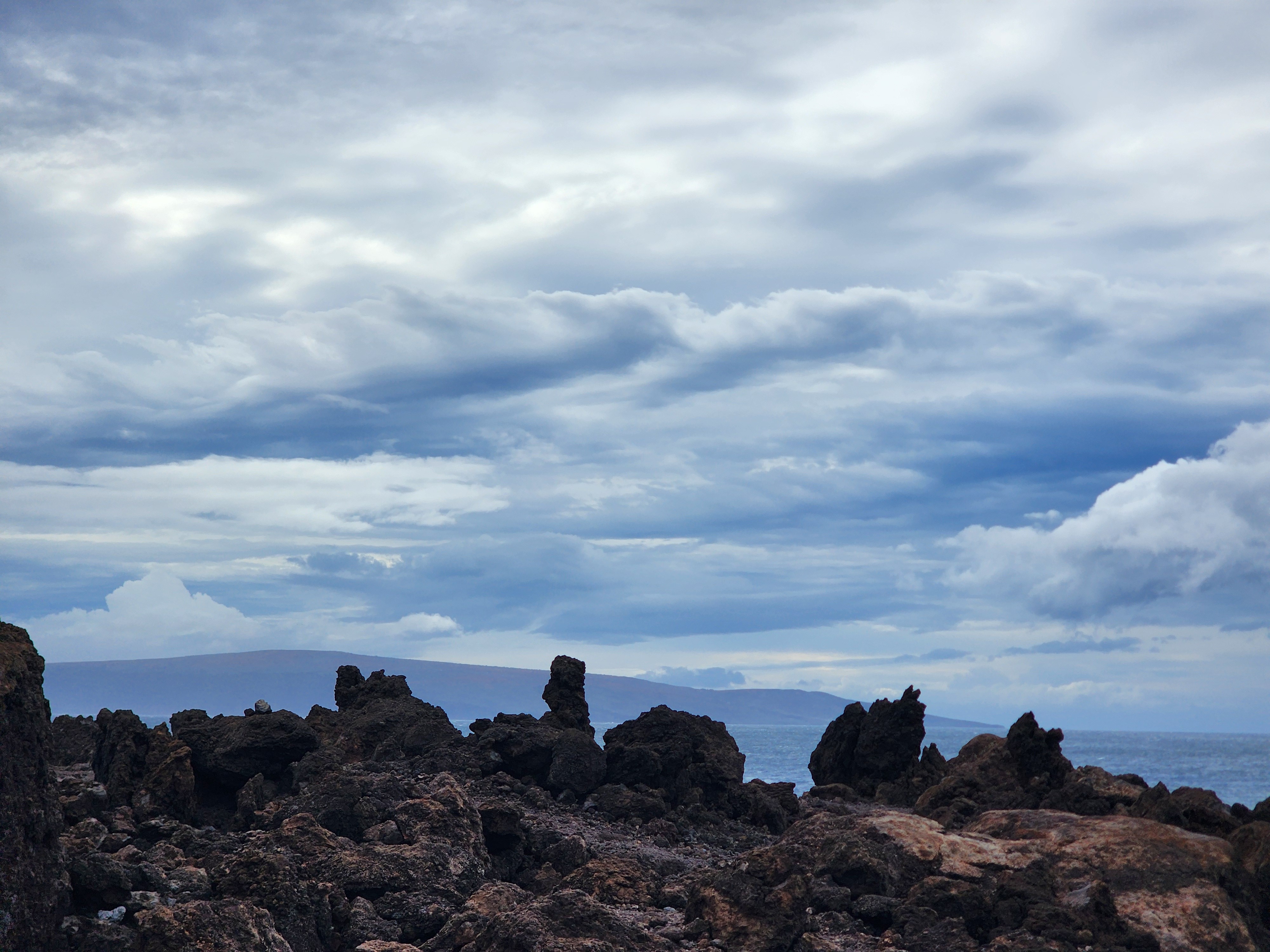
After crossing lava and beach, you finally arrive at the official Hoapili Trail - Trailhead. Here, the trees fade away and it truly is lava rock in every direction. Zoom out on Google Maps and you realize you're entering a mile-wide lava flow — its edge as clear today as it was in the 1700s, or the 1400s, or whenever the lava was last hot.
We were now a mere half mile from the lighthouse. We were home free — or so I thought. As we walked, storm clouds gathered in the west. Then some drizzle. Then rain. With zero cover, Shira wasn't having it — and I had to admit I didn't know what kind of storm was rolling in. Could we sprint the last quarter mile and snap a picture of Hanomanioa Light?
No, we decided. The prudent choice was to retreat. By the time we made it back to the Hoapili Trail head, the clouds had cleared and the weather was back to being perfect. Clearly, the gods wanted us to avoid Hanomanioa Light, and it was best to simply take the hint.
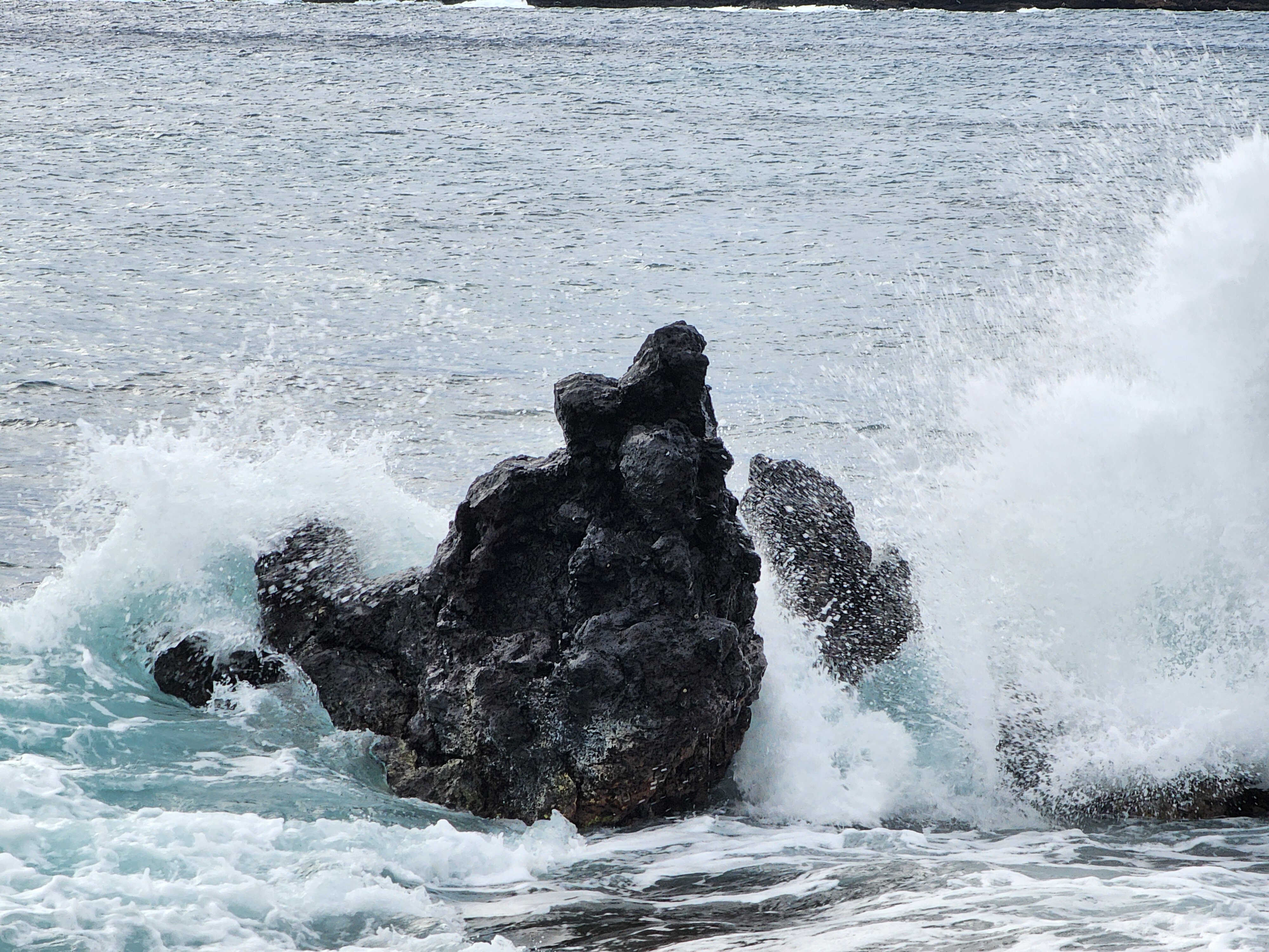
The less poetic version, which I only pieced together once I got home: this dry southern tip sits in Haleakalā's rain shadow, sheltered from the trade winds that soak the rest of Maui — which is exactly why the lava out here is desert. Serious weather does reach it, but rarely, and it comes from the opposite direction. Kona storms — kona is Hawaiian for leeward — are the winter lows that reverse the trades and park over the islands for days, pushing wind and rain in from the south and west and turning the island's calm corner genuinely mean.
We caught nothing of the sort. What turned us back was a squall — a few minutes of rain that blew through and cleared. But those clouds stacking up in the West, they certainly seemed to mean business.
The man who said no
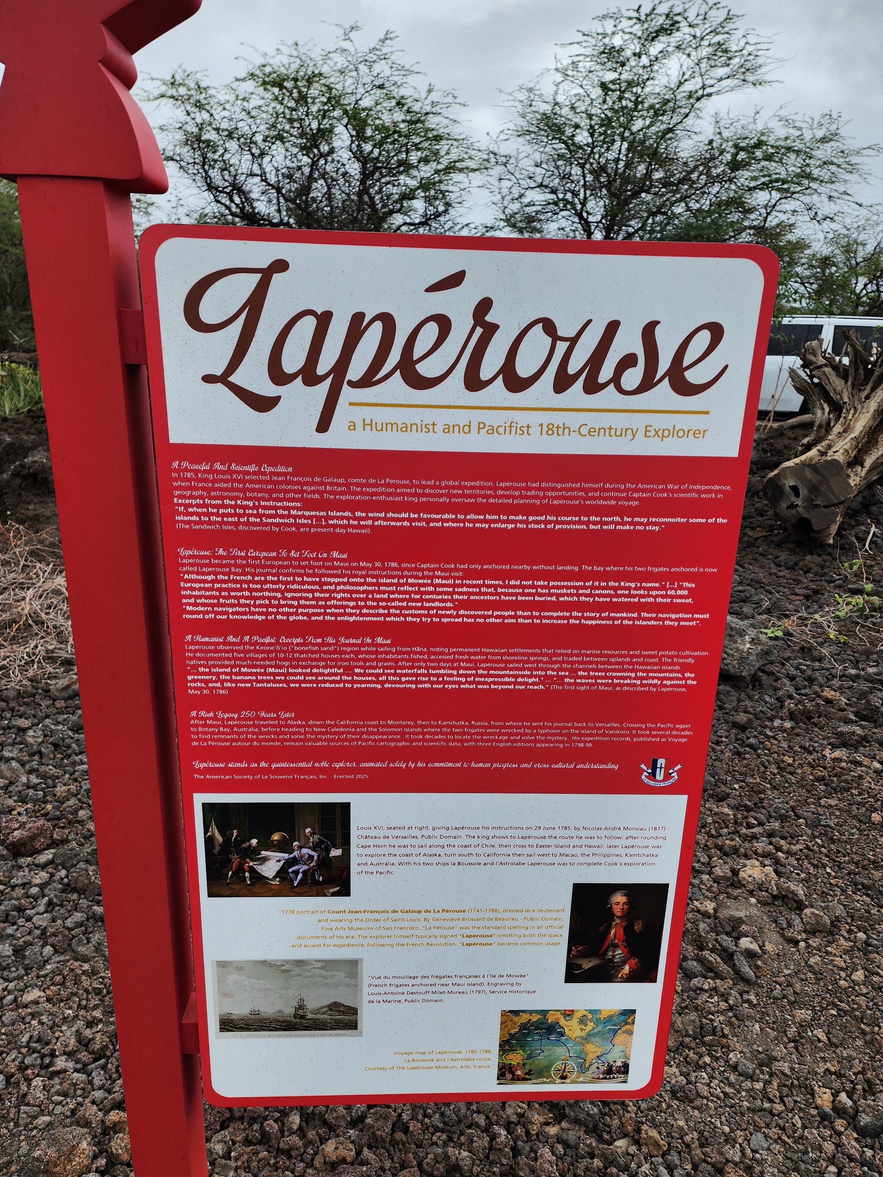
Before jumping in the car and leaving the area, take the short walk from the parking lot to the La Pérouse Monument.
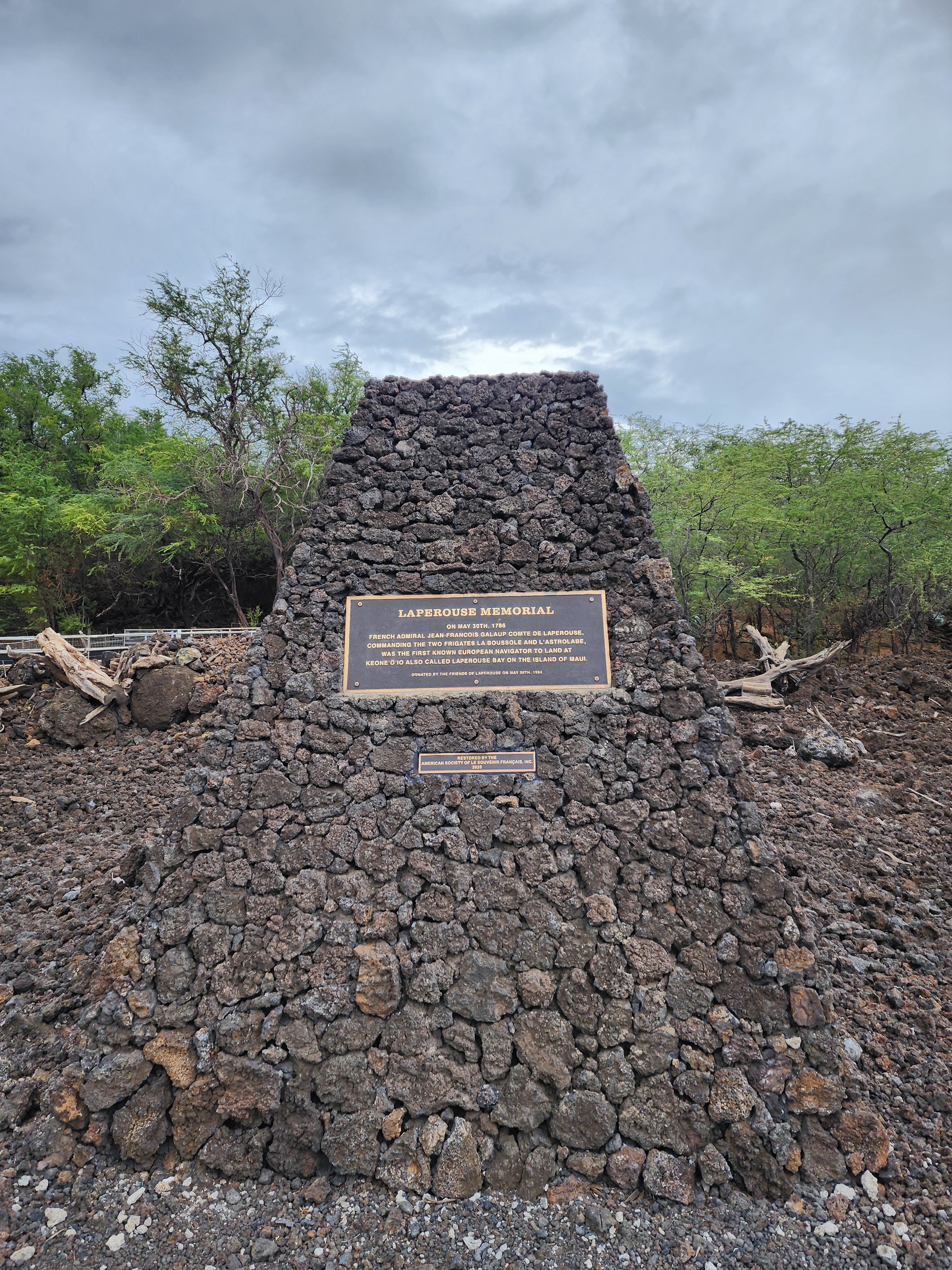
Jean-François de Galaup, comte de La Pérouse, was the first European known to set foot on Maui, in May 1786, at Keoneʻōʻio — the bay that now bears his name. And here's why he's worth the stop. Explorers of La Pérouse's era had a reputation for treating found lands as discovered ones — something to be claimed. Today we recognize that practice as cruel and deeply misguided. The surprising part: so did La Pérouse. He explicitly refused to claim Maui for France. He wrote:
"This European practice is too utterly ridiculous, and philosophers must reflect with some sadness that, because one has muskets and cannons, one looks upon 60,000 inhabitants as worth nothing, ignoring their rights over a land where for centuries their ancestors have been buried…"
Standing on a trail where the past keeps refusing to resolve into a tidy answer, it's a good note to end on: exploration didn't have to mean exploitation. One man, at the right moment, knew exactly what he was looking at — and chose to leave it alone. (More on him at Images of Old Hawaiʻi and the La Pérouse Headland memorial page.)
For those keeping track, I came up one brown sign short. We never did reach the lighthouse. But as I was on a run, mentally editing this blog post, it finally clicked. The thing I drive out to lighthouses for — an engineering marvel built to take the ocean's hardest blow and hold — I'd been crouched right over it on the rocks, guessing it was a limpet. The helmet urchin was my lighthouse. I just hadn't realized it at the time.
Tally it up: the King's Highway under my boots, the monument to the man who said no, and an engineering marvel to rival the one I'd driven out for. Two of three brown signs in hand, and nature quietly supplying the third. Hat trick confirmed.


For the data-minded, here's the full Garmin track — distance, pace, and elevation:
No comments:
Post a Comment