Showing posts with label carry. Show all posts

Tuesday, April 02, 2024

A Flyby of the Key Bridge Collapse

On a flight home from Rochester, New York we flew within about 10 miles of the collapsed Key Bridge. Even at this distant vantage point the scope of the disaster is mind boggling. Wow. Just wow.

The police radio chatter seconds before the bridge collapsed showed that they reacted quickly to stop traffic, no doubt saving a significant number of lives.

The whole incident underscores a rule I try to respect: when an emergency is reported, no matter how other wordly it must be, Just Go.

Monday, March 11, 2024

The ABC's of Easy to Forget Hiking Essentials

When I find myself in the backcountry and I'm missing some essential item, it's not usually because I've forgotten it. I mean, sure, that happens. There was that notable time when I grabbed my backpack from the trunk and trudged off for a 3-day backpacking trip, only to realize shortly thereafter I'd never changed into the boots still in the car.

Typically, I remember the item but talk myself out of bringing it. Bug spray? There aren't any bugs at the trailhead, so we should be good. Sunscreen? We put it on at the car, so why would we need to re-apply? Trekking poles? The hike is so short, why bother?

Fast forward a few hours, and you'll find us being bombarded by bugs, scorched by the sun, and Shira hobbling because she rolled her ankle during a gnarly section of terrain. At this point, I'm kicking myself for intentionally leaving essentials behind.

The solution to both forgetting gear and being shortsighted is the same: a checklist. For the last year and a half, I've come to appreciate that not all checklists are equal. A written checklist or checklist on your phone is good. But even better is one that you can mentally tick off. This allows you to confirm your checklist when you're packing, have a moment of downtime as the trip approaches, as well as when you're about to step off for the adventure. It's also possible to make a quick written copy of the checklist for times when the stakes are especially high.

A mental checklist sounds like a recipe for disaster, especially for someone like myself who doesn't have a gift for memorization. And yet, I've found that if I structure the items around a series of alphabetically arranged words, I can remember the list with ease. Try it, you'll be amazed at your brain's ability.

Below is my list of easy to leave behind hiking items and the prompts I use to remember them. This list isn't exhaustive, for example, there's no mention of a map or navigation aids. Instead, it focuses on the items that I'm quick to forget or think I can do without.

This photo shows a minimal version of the checklist below*

Agua - Water.

Boots.

Camera.

Deet & Derm - Skin protection from bugs and the sun.

EDC.

Food.

Gloves & Gripping - Gloves for me, Trekking polls for Shira.

Hat.

InReach - Comms: Garmin inReach and if in a group, Rocky Talkies

Jacket - Extra layers.

Kleenex - Bathroom kit (TP, hand sanitizer and a ziplock bag for packing out used TP)

Light - Flashlight.

Mylar - SOL heatsheet and other surival essentials.

No-Blisters - KT Tape to treat blisters and hot spots.


*Wait, aren't items on the list missing from this photo? The camera is my cell phone, which is being used to capture the snapshot. The bathroom kit, flashlight, SOL heatsheet and KT tape are all part of my EDC. I include them in the list so that I can use this checklist for others.

Friday, March 01, 2024

Thought for Food: Three Tiers of Food Preparedness

Because I'm on a gear posting spree, I thought I'd do one more post in this genre, this time on food.

There are countless videos on YouTube that discuss meal planning from backpacking, historical, and emergency ration perspectives. However, it was Justin Simoni's video on fastpacking nutrition way back in 2020 that really resonated with me. In it, he talks about his strategy for backcountry meal prep. He aims to achieve nutritional balance while also prioritizing simplicity. In his video, he described the food he took on a recent adventure, which consisted of just 4 items. This got me thinking: what would my minimal food setup look like?

Since then, I've been inspired by other videos, most notably Fandabi Dozi's historic survival rations. Additionally, Townsends and Steve1989 have been sources of ideas, with the former focusing on historic foods and the latter on MREs.

I've experimented with these ideas while hiking, camping, traveling, and in our kitchen. And while I don't have a one-size-fits-all food solution, I realized recently that I had settled into a reliable 3-tiered strategy. Here it is.

Tier 1: The EDC, Super Food

My latest man-bag dump reveals my new everyday carry food of choice: Peanut M&M's. Over the years, I've experimented with a number of always-with-me snacks. For a while, it was a Lara Bar, and then for even longer, it was peanut butter packets. Peanut butter packets are dense, so they pack quite a bit of calories in a small volume. But I'm telling you, I've found my super food: the ubiquitous Peanut M&M. Hear me out.

The peanuts in Peanut M&M's provide a healthy source of fat and protein, the chocolate provides quick energy, the candy coating keeps them from melting, and they taste delicious. They are highly available, often being stocked by even the smallest convenience stores. Critically, they are also portionable. This means that I can easily share them or pop just a couple should I start to feel peckish. Try that with a peanut butter packet. They are bulkier than a peanut butter packet, but they are still dense. Consider this: that this small ziplock bag contains 750(!) calories. That's a massive number of calories for such a small space.

Peanut M&M's also have a proven track record, as they are one of Justin's four items from the fastpacking nutrition video I mentioned above.

Tier 2: If A Meal Will Be Missed

When I expect I'll be missing a meal or two, I'll look to tier 2. This includes long hikes, road trips, and most often, flying. It seems that no matter how short a flight is, it's always over mealtime. No worries, I've got a plan. The goal here is to have shelf-stable food that I can easily eat on the go and has some nutritional variety. This tier consists of:

I realized my food strategy was additive, as it builds on the benefits of Tier 1. Ritz Crackers add a savory, salty, carb-heavy component. The Moon Cheese is a great source of fat and protein and adds another flavor profile. I can combine the items into a sort of trail mix, eat them separately, or pair any of the items together. This combination of foods won't check the boxes for your CrossFit Macros, but it does provide at least a variety of carbs, fat, and protein. The crackers and Moon Cheese do fine in both hot and cold conditions and even make minimal trash.

The Moon Cheese is a splurge cost-wise. I've found that buying it on Amazon is most cost-effective. Still, for the nutrition, taste, and portability, I've yet to find a better solution. The Ritz Crackers are mainly carbohydrates, so they aren't nearly as dense as M&M's or Moon Cheese. They can also crumble when stuffed into a backpack. Yet, given how cheap, available, and tasty they are, they are a winner.

Speaking of proven track records, history buffs will appreciate that the Ritz Crackers stand in for the traditional hardtack or ship's biscuit that soldiers and sailors depended on for centuries. I experimented with making my own hardtack as well commercially available options. While these score some authenticity points, in practice, Ritz Crackers are far more convenient and check the carbs box just as well.

For reference, the above photo contains 200 calories in Moon Cheese, 650(!) calories in M&M's, and 900 calories in Ritz Crackers. So this easily covers multiple meals, individuals, or days, depending on the circumstances. When traveling, I'll often use of Shira's old gum containers to store the Moon Cheese and M&M's. This particular container has a flip-top lid which can be used as a dispenser and it saves me on having to use and toss a ziplock bag. I also typically carry a small binder clip to re-seal the Ritz Crackers.

Tier 3: Multi Day Meals

When circumstances call for supplying multiple days' worth of meals, I turn to Tier 3. This covers backpacking, camping, or living out of a hotel room for a few days or longer. I also keep a healthy supply of these items on hand at home, so should we find ourselves sheltering in place due to a storm or some other dramatic event, we won't go hungry. This tier continues the trend of being shelf-stable and relatively nutritionally balanced. It adds the dimension of variety to make multiple meals more palatable.

This tier includes a few items which call for preparation with boiling water. This is typically available in both the backcountry thanks to a stove or fire, and in a hotel thanks to a coffee maker or immersion boiler. However, none of the foods below actually require hot water to be consumed. The instant rice will reconstitute in cold water without a problem, and I regularly drop tea bags into a cold water bottle to make a quick and tasty drink. For this blog post, I even experimented with mixing hot chocolate mix with cold water. The result: cold hot chocolate. I'm not sure this is anyone's first choice for a drink, but it was certainly palatable, and on a hot day, this actually may be a treat.

Here's Tier 3:

Carbs

  • Ritz Crackers
  • Flour tortillas
  • Minute Rice

Protein

  • Moon Cheese
  • Peanut butter
  • Tuna fish packets

Brewing

  • Soup mix
  • Hot chocolate
  • Tea

Extras

  • Peanut M&M's
  • Builder Bars

Like Tier 2, it's possible to mix and match these items to form a variety of different meals. Meals can be as simple as slapping some peanut butter on a tortilla, or as complex as combining rice, soup mix, tuna fish, and Moon Cheese to make a sort of tuna salad. It's equally possible to grab a Builder Bar and a handful of M&M's, or boil water, bust out utensils, and eat a more proper meal.

When traveling, I'll typically supplement these items with whatever else strikes my fancy at the local grocery store. So Tier 3 often serves as more of a base pantry rather than my sole set of food choices. Still, I find it very helpful, especially after a long day of traveling, to go into a grocery store with a tested shopping list. Otherwise, it's very easy to walk out and realize that you forgot some obvious essential. I've also found it reasonable to travel with these items, even though they are available at most destinations. That's because it's possible to pre-portion them to the right sizes at home, rather than having to deal with whatever is available on-site. For example, if it's just a couple of days that I need to account for, bringing four tortillas is often a better choice than having to buy a package of 20 at the local grocery store.

So there it is, my three tiers of food prep. Do you have any go-to camping, traveling, or emergency foods or food strategy? If so, please share!

Tuesday, February 27, 2024

Man-Bag Dump, 2024 Edition

I've talked a bit about the philosophy behind what goes into my man-bag, now let's get into the kit itself.

Purse Things

Most of these items are ones that I have carried for years. One new addition is the USB rechargeable dog collar light that gets attached to the outside of my bag. It adds visibility when I'm walking at night and serves as a task light for up-close work. Unlike other small safety lights I've tried in the past, it's USB rechargeable. It's a bit thicker than I'd like, but otherwise, it's just about the perfect marker light.

I've been experimenting with carrying a few compressed towels. I added these because I found myself stepping out of the house too often without grabbing a handkerchief, an item that I find to be absolutely essential. I'm thinking the towels may be able to serve as a field expedient replacement. We'll see if they get any use; if not, they'll be evicted from the bag.

Finally, I'm on the fence about carrying the mini-deck of cards and dice. On one hand, these are great for entertainment and improvisational purposes. They are also quite compact. Yet, I'm still not entirely convinced that their bulk is justified. Time will tell if they prove their worth.

  • Buff
  • Flip & Tumble shopping bag
  • Pepper spray
  • Glasses pouch
  • Peanut M&M's
  • Dice and Cards
  • Marker light
  • Glow in the dark tape
  • Reflective tape
  • Extra cash
  • Backup credit card
  • Fresnel lens
  • Large sewing needle
  • Tissues
  • Res-q-me glass punch
  • Car keys
  • Hair band
  • Nitcore TIP flashlight
  • Compressed towels

Tech Stuff

Recently, I've made a significant improvment in the tech side of things. I replaced three specialized cables, a USB C, USB Micro and Garmin Watch Charger with two USB C cables and teeny tiny adaptors. The adapters turn the USB C cables into the other varieties that I need. My phone makes use of a USB C cable, so having two of those cables is very handy.

I'm still making use of the same relatively small Anker battery. While the battery can only bring my phone to 80% of a charge, I find that's sufficient and allows me to save on the weight that would come with a larger battery.

  • Folding keyboard
  • Anker battery
  • USB C cables
  • Wall adapter
  • Micro SD cards
  • Micro SD to SD card adapter
  • USB C to 3.5mm adapter
  • USB C to USB Micro adapter
  • USB C Micro SD card reader
  • USB A Micro SD card reader
  • USB C Host on the Go adapter
  • SIM tool
  • Backup cell phone
  • Headphones

Drugs

After a hot glue gun incident, I took the hint and added a couple of packets of burn cream to my kit.

Surprisingly, the cough drops saved the day a number of times last year. Who knew how handy they would be?

Not shown below is a 24-hour supply of meds for both Shira and myself. I think it's pretty essential to always have these on hand, as they simplify being stuck somewhere unexpectedly for the night.

  • Cough drops
  • Claritin D
  • Anti-diarrheal
  • Burn cream
  • Cortisone cream
  • Aspirin
  • Benadryl
  • Dramamine
  • Drip-drop rehydration
  • Crystallized lemon flavoring
  • Melatonin
  • Ibuprofen
  • Band-aids
  • Leuko tape

Outdoors and Emergency

Finally, we come to a few odds and ends, many of which make sense in an outdoor setting. Though the plastic bags are especially handy for when we travel with kids and the threat of car sickness looms.

The tea bag is mainly there for its caffeine, so technically it belongs in the 'drugs' section. Yet, this advice I read nearly 10 years ago still resonates with me, causing me to store it among my outdoor gear.

The trauma kit is detailed here (it's the pocket variety). I keep it vacuum-sealed for easy access.

  • KT, Leuko, and Duct tape
  • Portable Aqua tabs
  • Bic lighter
  • True Liberty bags
  • Quart-sized Ziplock bag
  • KN95 Mask
  • Ear plugs
  • CPR Mask
  • Tea bag
  • Trauma kit

Monday, February 26, 2024

Man-Bag Dump, 2024 Edition: Let's Talk Philosophy

It's been four years since I last posted a bag dump of my man-bag, so I'm overdue to post a fresh snapshot of what's inside. However, before I get into these details, I thought I'd talk a bit about the philosophy behind the gear and its selection.

At a high level, I'm striving to balance the 3P's of gear selection: Preparedness, Practice, and Predictability.

Preparedness

Preparedness is the most straightforward attribute, and here my gear tends to fall into one of four buckets. First, there are convenience items. These tend to be frequently used but low-impact. That is, I use them fairly often, but it would be more of a nuisance than a catastrophe if I went without. This covers things like a reusable shopping bag to avoid accumulating more plastic, a microfiber cloth to clean my glasses, or a dose of Claritin D, which has saved me from a number of annoying allergy attacks due to cat allergies.

Next, there are tech items. Some of these are pretty obvious: ways to charge my cell phone and headphones to turn any space into one where I can get lost in media. Other items may seem over the top, like a folding keyboard and various USB adapters. These items let me turn my phone into a Linux workstation. From there, I can help rescue my customers if their servers go down, or tackle countless other tasks that benefit from having a laptop.

There are also a few outdoorsy items, like a Bic lighter and Aquatabs. I spend enough time outdoors that it's reassuring to always have these items on me. I'm also keenly aware that while I may be planning a day full of indoor activities, I may unexpectedly find myself in nature.

Finally, I carry a few doomsday items. These are on the opposite spectrum of the convenience items: used infrequently, but with high impact. Examples of these items include a trauma kit, a glass punch for escaping or getting into a vehicle, and digital copies of important documents. I'm just as disbelieving as the next person that I will ever need these items, yet there's ample evidence to suggest that nobody is immune from these crises.

Practice

Gear is good. But gear plus experience is far superior. But how does one get this experience? One way is through deploying your kit even when it's not entirely necessary. This is what I identify as the goal of practice.

For example, every so often I'll charge my phone from my bag's battery pack even though there's a perfectly usable outlet in front of me. Or I'll use that bag's flashlight when Shira and I go on a winter evening's stroll through our neighborhood even though we could probably forgo a light altogether. Or, I'll grab my folding keyboard and use it and my phone to respond to any work issues that have come up overnight, even though a proper computer is just a few paces away. What these detours lose in efficiency, they more than make up for in experience. I get to learn firsthand if my battery pack is still holding a charge, if the flashlight I intend to depend on in emergencies is as bright as I expect it to be, and if my phone is still on speaking terms with the Bluetooth keyboard I intend to deploy to rescue a customer's server.

Predictability

Finally, there's predictability. That is, having a very high degree of confidence that your gear is where you expect it to be, and that it is ready to perform. Predictability is key when a situation is stressful. In these conditions, the last thing you want to be worrying about is your equipment.

For example, while on a camping trip with our nieces and nephew, I was separated from Shira and needed to give her a call. I reached for my phone and found, thanks to the heap of photos I'd taken and my neglecting to charge it the night before, that it was dead. Without missing a beat, I pulled out my battery pack and a USB cable, and within a minute or two, I was on the phone with Shira. I didn't need to think: did I pack the battery pack? Did I bring it on our hike? Did I have a working charging cable with me? This was handy for the low-risk scenario of my phone being dead, but I imagine this would make a world of difference should I ever need to deploy one of those doomsday items I mentioned above.

Finding a Balance

The thing about these three goals is that the first one is in direct conflict with the last two. Preparedness can be solved by bringing lots of stuff. But, practice calls for your kit to be as portable as possible, so you'll take it with you and use it as often as possible. Similarly, predictability is optimized when you have fewer items in your kit, as there's less to mentally track and to physically maintain. In short, it can be just as valuable, if not more so, to remove items from my man-bag than it is to add them.

Ultimately, searching for this balance is a game of trial and error. I'm always looking for that sweet spot of having the most effective gear with the fewest items in my kit. Up next is a snapshot of my latest setup.

Tuesday, October 24, 2023

On the Difference Between Answers and Understanding

Both my Father and my Father-in-Law (z"l) were science teachers. Between my Dad's teaching non-majors and my FiL teaching high school, I'm certain they both strived to impart a love and appreciation of science to a skeptical audience. In their own ways, they imparted to me the fundamental difference between understanding versus simply having the right answer. My father-in-law would pour over physics textbooks the same way most people would re-read a favorite novel; all along the way relishing the fundamental. My Dad would pass along the warning he gave his students about spreadsheets: they'll always give you an answer, but is it the right answer?

Yesterday, as I fiddled around with the math behind stadiametric range finding I had a moment where this notion of understanding a topic crystalized. Typically, range finding is used to find an unknown distance. The forumula I was working with was as follows:

ad   od
-- = --
ah   oh

In every YouTube video I saw on the topic, the goal was to calculate the distance to some target, ad (actual-distance). But, it ocurred to me that you could use this same forumula and technique, yet flip around what you're solving for.

Say you were with a buddy and you wanted to run some 100 meter sprints. You could plug the known values into the formula above:

100m    66cm
----  = ----
5'6"     oh

In this case, we can solve for oh (observed-height). Doing this, comes to:

(100m / 5'6")        = (66cm / oh)  ; plug in the numbers
(10,000cm / 167.64cm) = (66cm / oh)  ; convert to cm
(66cm x 167.64cm) / 10,000cm = oh ; solve for oh
1.1cm = oh

This is what 1.1cm looks like marked out on my wallet-sized ruler:

I can now find 100 meters by walking away from my buddy and every so often holding this marked-off ruler out in front of me. When my running partner completely fills the marked off bounds of the ruler, I I've hit 100 meters. Science for the win!

While this may be a very minor bit of mathmetics, it made me smile when it all clicked for me. I'm confident both Dads would appreciate my little discovery and that I'm grasping their wisdom.

Over the years, I've watched as answers have become easier and easier to come by. Calculators, spreadsheets, Google, Wikipedia and Stack Overflow; oh how wonderful these services can be and how quickly they can reveal an answer. And now we seem to have reached peek-answer availability with Chat GPT. You can not only have the answer you want, but in your preferred voice and tone. Who could ask for more? And yet, understanding is still the gold the standard. Perhaps Shel Silverstein put it best:

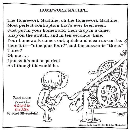
The Homework Machine,
Oh, the Homework Machine,
Most perfect
contraption that's ever been seen.
Just put in your homework, then drop in a dime,
Snap on the switch, and in ten seconds' time,
Your homework comes out, quick and clean as can be.
Here it is— 'nine plus four?' and the answer is 'three.'
Three?
Oh me . . .
I guess it's not as perfect
As I thought it would be.

Monday, October 23, 2023

The $1.50, Ultra Compact, Field Expedient Rangefinder

I wanted to see if I could DIY a stadiametric rangefinder. But, before I could start crafting I needed to understand the math behind this distance estimation technique.

One clue as to how stadiametric rangefinding is calculated, comes from the unit of measure found in military spotting scopes: the mil. Mil stands for milliradian and is a measure of angular distance. From this, I inferred that I was going to be digging into trigonometry. I braced myself some complex math. When I finally untangled the how this all works, I found the process to be delightfully simple. In fact, we can trivially derive it.

Decoding the Math

Consider this crude drawing of me standing in front of an object:

The object is ad (actual-distance) away from me, and is ah (actual-height) tall. Assume that I know ah, and am trying to figure out ad. Now imagine I grab a ruler and hold it up in front of me. The picture now looks like this:

The length of my arm is od (observed-distance), and I can read off of the ruler how tall the object appears to me, oh (observed-height).

The magic, if you will, is that these measurements are in proportion. That is:

od   ad
-- = --
oh   ah

Intuitively, this makes sense: how tall the object appears to me is directly related to how close I stand to it. But, there's no reason to trust your gut here: the mathematical principle in play is similar triangles and it's more than worth your time to read up on it.

As with any proportion, if you know three values you can calculate the fourth. This suggests that there's nothing to actually build to create this type of rangefinder. I simply need a ruler I can hold out in front me. As luck would have it, the wallet sized fresnel lens I carry in my man-bag has both inch and centimeter markings on it. By the principles above, I should be able to calculate distances in the field using it. Let's try this out.

Let's Try It

I situated myself on the edge of my driveway and peered down to a bank of traffic lights in the distance. My goal: find the distance to the traffic lights.

I held up the wallet sized magnifier, and read .7 centimeters off of it. Keep in mind, all I'm interested in is the ruler on the magnifier; I'm ignoring the magnification itself.

Using a sewing style measuring tape, I measured the distance from my face to my outstretched arm. That came to 66cm. I also Googled around to figure how out how tall a bank of traffic lights may be. The consensus was that each light was 12". So I used: (12" x 3) + 4", or 40", as my estimate. I now had all the information I needed to fill into the formula above:

(ad / ah)      = (od / oh) ; the formula
(ad / 40")     = (66cm / .7cm) ; known values plugged in
(ad / 101.6cm) = (66cm / .7cm) ; inches to cm
ad             = 101.6cm x (66cm / .75cm) ; solve for 'ad'
ad             = 9,579cm ; divide and multiple values
ad             = 95.79m ; convert cm to m

According to the math above, the stop light was about 96 meters away. I then pulled up Google maps, switched to satellite view, and measured the distance on the map. It came out to a shockingly close 92 meters. I'm amazed that my estimate was so close to what I measured in Google Maps. Still, I suppose the math is sound, so I can't really complain.

A Little Field Prep

While there may be nothing to build to do this kind of range finding, there is important information to know. To make performing these calculations in the field easier, I created a text file containing some common unit conversions, as well as some sizes of standard objects (thanks range-r-card for inspiration!). Here's what in the file:

Arm length: 66cm

To centimeters
inch x 2.54
feet x 30.48
yard x 91.44
meter x 100
kilometer x 100,000
mile x 160,934

From centimeters
cm / <factor above>

Objects
traffic light: 12" (30.48cm)
person: 5'9 (175.26cm)
avg SVU: 1.9m (190cm)
door: 2m (200cm)
semi truck: 3.5m (350cm)

I printed this information out as a cheat sheet and did a bit of poor-man's laminating by covering it with packing tape. I then tucked it in to the same slot that holds the fresnel lens.

And just like that, I'm ready to do some field expedient distance estimation. And best of all, the setup was free and doesn't add any bulk to my gear.

Friday, October 20, 2023

In Search of a Low Cost and Compact Field Expedient Distance Calculator

Imagine you're a sniper (or hunter, or golfer, or surveyor), to do your job you need know the distance from yourself to some far off point. To get this value, you'd probably reach for your high tech laser, infrared or sonic rangefinder. But what if you're rangefinder's batteries are dead or the device damaged? All isn't lost, as you're probably using an optic that includes a ticked-crosshair like this:

Those dots aren't just for decoration, they are designed for estimating distance. This method is known as stadiametric range finding, and it works by having the viewer plug two values into a math formula. The values are the actual height or width of an object in the scene, and the number of ticks the object takes up in the scope. For example, if you know there's a 5'6" (1.67 meters) person in the scene, and this person takes up 3.5 ticks in your mil-dot scope, then you know that you are approximately ((1.67 x 1000) / 3.5), or 477 meters away from that person.

This method is handy because you don't need a special piece of tech to use it. The optic you are already schlepping around can have this built in. There's nothing extra to carry, break or forget.

What interested me however, was whether it's possible to use this same technique without an optic. Whether in a wilderness or urban setting, being able to estimate distances would be a handy skill. I can't, however, justify carrying around a mil-dot monocular on the off chance I'll want to measure a distance.

The good news is that you can absolutely do stadiametric range finding without magnification. The range-r-card by Black Hill Designs does exactly this. You hold the plastic card in front of you, and estimate distance using the same principle as a mil dot reticle.

While more purpose built, the Dead On Range Finder does the same thing. The Dead On is used by bow hunters, and on the surface doesn't look anything like a sniper's scope or range-r-card. However, the principle remains the same: you know an object's size in the scene (the average belly height of a deer), an observed size of this object and therefore, an approximate distance.

This type of range finding isn't new. Back in the 1800's when soldiers switched from muskets to rifles they found themselves with both an opportunity and a challenge. Rifles had a much larger range than muskets, but one could only take advantage of this if you could properly estimate the distance to your target. The December 1st, 1869 edition of the North Iowa times gave this grim prediction if the challenge of fast and accurate range finding was ever solved:

An Italian officer is reported to have made a discovery, by means of which any private soldier is enabled to measure the distance of any object within range, instantly, and at the same time to aim a gun or canon with unerring accuracy. This would make all firearms such murderous weapons, that two detachments of troops within range would be enabled to utterly destroy one another.

During the Civil War, the US issued stadia to select soldiers as a means of doing, you guessed it, primitive stadiametric range finding.

The Civil War stadia, like the range-r-card, works by holding the device at just the right distance from your eye by having the operator bite down  on, and extend a cord. When an enemy soldier fills up a marked section of the stadia, you effortlessly know his distance.

While both the range-r-card and 19th century stadia replica are relatively cheap and compact, I was curious if it was possible to DIY a solution from gear that I already carry. That way, I won't have to take up space on a purpose built item that will get used infrequently.

Stay tuned, I'm planning to tackle that challenge next.

Wednesday, August 16, 2023

Review: Manual of Field Sketching and Reconnaissance

How do you make a map of an arbitrarily large area without the benefit of GPS or other modern instruments? And how do you do this while under fire from the enemy? The Manual of Field Sketching and Reconnaissance, published in 1903, covers precisely this topic.

The recommended answer, by the way, involves setting an appropriate scale (say, 1 inch = 1 mile), methodically measuring and plotting out a number of points in that scale (say, walking 1.5 miles and then drawing the corresponding a 1.5 inch line on your paper), and then using these established points to triangulate other notable locations on your map. Finally, add symbols, text and perhaps contour lines and bam! you've got a map!

Admittedly, this process isn't quite as easy as I'm suggesting above. But, it is certainly a learn-able skill, and requires only the minimum of technology to accomplish.

Because the manual is written for the creation of maps and reports during war time, there's an emphasis on being creative and improvising. For example, rather than measure distances using precise instruments like chains, a number of other option are given:

The straight lines, called traverse lines, are measured with a chain or tape, or by pacing, or by cyclometer, pedometer, perambulator, or by time, or by estimation.

If if you're performing recon of an area by horseback, then this advice would be especially handy:

As regards the measurement of distances when sketching on horseback, it used to be the custom to count the horse's paces. But this system has great disadvantages; it is vexatious and laborious, and the resulting preoccupation of mind prevents the sketcher from looking about him and studying the country through which he rides. By far the best way is to measure distance by time.
  Allow 12 miles an hour for a canter,
        8  „                 „ trot, 
        4  „                 „ walk,
under normal conditions.*

Then draw a scale of minutes at the trot on the ruler.
Thus: Scale of sketch 2 inches to 1 mile,—
In one minute at a trot 8/60 mile, or 235 yards, will have been covered, 235 yards at 2 inches to 1 mile = .27 inch.

One aspect of the text which I found unexpectedly eye-opening was the chapter on scale. As a map reader, scale isn't something I'd given a whole lot of thought to; it just is what it is. But, as a map creator, the choice of scale has far reaching implications. Say you have a 10 by 10 mile area you'd like to map. If you're working with an 8½x11 inch sheet of paper, then a 1 inch per mile scale simply won't fit on the page. The scale you choose directly reflects how much detail you can capture on a map. I'm so used to digital maps where you can zoom in and out, effectively morphing the scale at will, that the idea of picking one scale to work in is truly an exercise in balancing competing needs.

I found the section on night time sketching to be enlightening. In the early 1900's the flashlight would be considered futuristic tech; invented but hardly practical. Yet, I was surprised to learn that luminous paint was available. The idea of marking compass points with this type of paint seems modern, and yet, this is precisely what the manual recommends. This theme of finding seemingly modern map and navigational concepts in the text was common. For example, the role of countour lines or how your location on the globe impacts your magnetic North, are just two small examples of this phenomena. While the language of this text seems dated at times, so many of the concepts are as true today as they were back then.

Overall, I found the field manual to be a fascinating read. There's practical advice here that's useful in situations when you don't have access to a GPS or Google. But more than that, the book is a window into the mind of the map maker. This volume contains an impressive number of reproduced maps. These show, even under trying circumstances, the kind of high quality creations that can be authored when soldiers in the field combine skill, improvisation and artistry that's called for in this text.


Monday, August 14, 2023

Travel Games: Kid Tested, Uncle Approved

Traveling to Tucson with 5 kids, I wanted to be prepared with plenty of offline activities. Here's a handful of games that we brought and how they faired among the kids.

Kariba: Winner! Shira and I walked into Labyrinth Games & Puzzles in DC and said: we need an easy to travel with game that 5 kids--pre-teens to teens--are going to love, what do you got? Without missing a beat, they pointed us to Kariba. And they nailed it. Kariba is fast to learn and fun to play. It requires enough thinking to be engaging, but it's not so intensive that you can't kibbitz about other things while playing. It was a hit.

Bandido: Good, maybe great. Bandido is another compact card game. This one is cooperative and is a "route building game"; a form of game that was new to us. We have yet to beat the game, and so we haven't had the thrill of winning yet. But, that's probably a good thing as we've played this only a few times and it's cooperative so it should be tricky. This game is probably more suitable for older kids who are interested sticking with a challenge. Still, it's compact and clever, so perfect to travel with.

Lucky Doug 12-in-1 STEM Solar Robot Kit: DO NOT BUY. Don't do it. Trust me. Don't buy this. This isn't a game, but I figured building a robot would be a fun way to keep the kids occupied. Alas, this kit is a disaster. We spent the first 30 minutes of the building process unclipping tiny plastic pieces and putting them in tiny plastic bags; all the while imagining that we'd surely lost or damanged one of the tiny plastic pieces. When we finally got to building stage, we found the instructions complex and the pieces impossibly finiky. If you're an adult who likes to build complex puzzles, or a masochist in general, then enjoy. But yeah, this is not a kids toy.

Mate: Clever, unique, and accessible. Mate is card game played with a standard deck of cards that is a sort of distant cousin to chess. Mate, like chess, is a "game of perfect information: both players know the location of all cards from the start." This was a great game to experiment with when I had one on one time with the kids. We didn't play it enough to get out of the awkward learning phase, but I've added it to my offline games repository, so I hope to keep playing it. I love that you get to sharpen the skills involved in chess but in a more portable package.

Snip Snap Snorem: quick, all-ages fun. We didn't play this card game this trip because I'd forgotten about it, but in the past it was a staple. It was especially useful in restuarants when the kids got antsy and we were waiting for our food. I've added this to my offline games list so I'll have it at the ready in the future.

Yu-Gi-Oh!: Kids loved it, I was utterly confused. Early in the trip, J took out his Yu-Gi-Oh! cards and asked if he could teach us to play. We were all psyched to give it a go. Within seconds of him explaining what was going on, I was lost. To my surprise, the other kids were totally tracking. The thing is, it wasn't that J was bad at explaining things; there's just a heap of new concepts that you need to hold in your head at once, and my brain wasn't having it. Consider this how-to play page. It starts off gentle enough, explaining:

The Yu-Gi-Oh! TCG is played in turns that follow a specific order of operations. To begin a duel, the decks are shuffled and each player draws an opening hand of five cards.

OK, fair enough. That makes sense. But then, in the very next set of instructions, it becomes overwhelming:

In this phase, you make most of your non-combat actions. These include the normal summon/set of one monster (in face-up attack position or face-down defense position respectively), any special summons you are allowed, the activation/setting of spells and traps, and changing battle positions of your monsters, including flip-summoning facedown defending monsters into the face-up attack position.

Wait, what? That second sentance contains like 8 different operations you can perform. Mind. Blown.

What I need to do is hire a 10 year old to coach me to success. Just you wait kids, next year I'll be flip-summoning monsters in attack position in no time!

Tuesday, June 13, 2023

Building your own Noah's Ark. But smaller and for knowledge.

Imagine for a moment: life without the Internet. Along with a heap of other conveniences, gone is effortless access to information on any conceivable topic. While extended periods of time without free and easy access to the web are hard to imagine, the cost for preparing for this contingency is tiny. Doing so takes up no physical space, is essentially free and the content won't expire.

The only real effort involves a thought exercise: what content do I want when our imaginary doomsday hits?

Sites like TruePrepper take a decidedly functional approach to this challenge. They recommend books and manuals to sharpen your survival skills. Survivor Library offers a more holistic approach. While they have an extensive section on individual survival , they have a broader mission: to provide the wisdom needed to power a society. They offer books on everything from accounting to weaving (what, no zoology?).

Initially, I thought I might download the documents on the Survivor Library, copy them to a Micro SD card and be done with this little experiment. But, as I started to think about what documents I'd want access to, it occurred to me that quality, not quantity is the goal. You can see what I've come up here, and the list continues to grow as ideas strike.

Once I had a list of URLs to PDFs, the next step was to write some code that would download these files to my computer. Once downloaded, I can copy them to a Micro SD card for safe, Internet-free keeping. As a bonus, I opted to copy them to an Amazon S3 bucket. This cloud based backup is useful if the original sources on the web become unavailable. The script libraryassist handles these uploading and downloading tasks. Here's the script in action as I ask it to process the 'medical' related documents I added to my catalog:

# Pull down documents from the web
$ ./libraryassist -a get-all
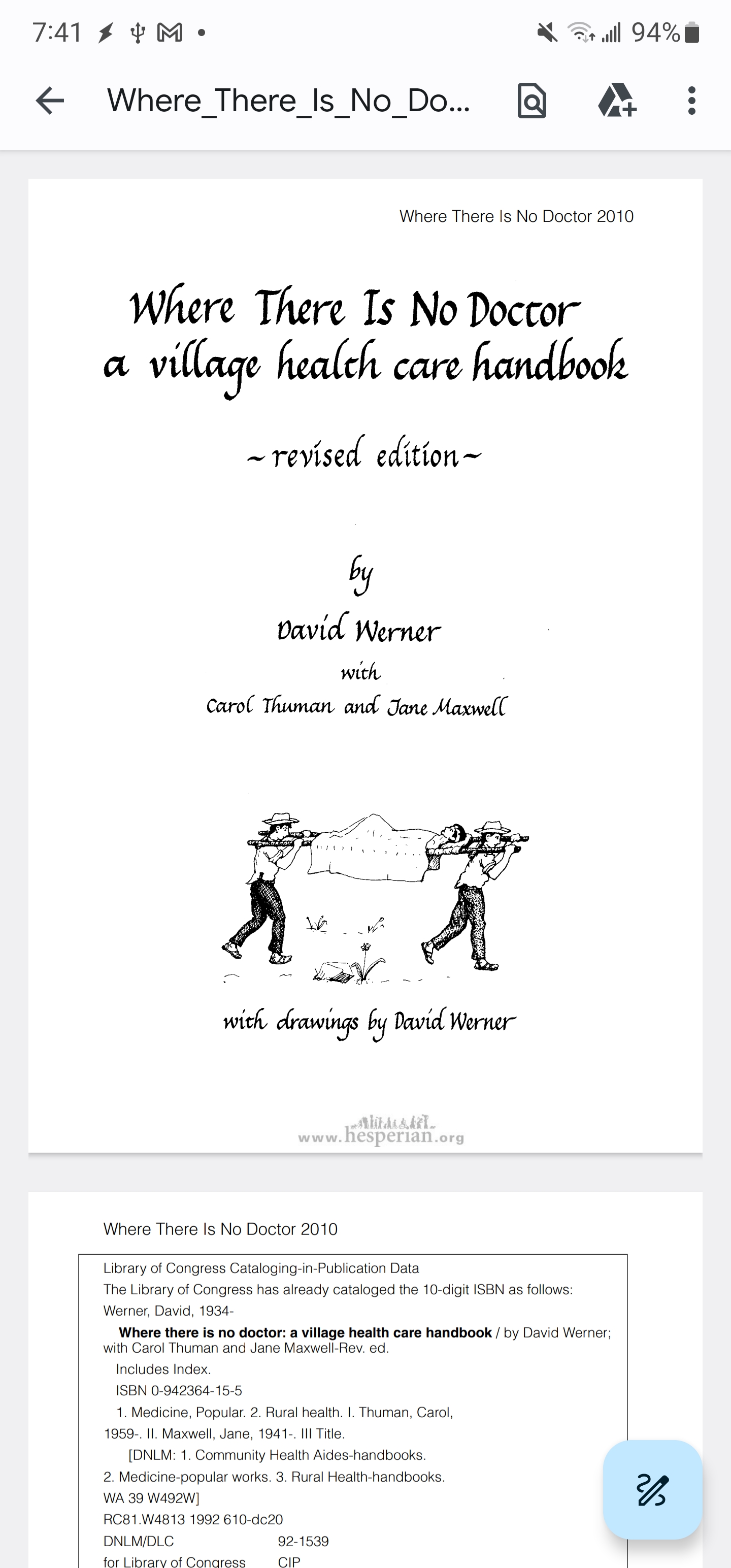
medical: Where_There_Is_No_Doctor.pdf (https://ia800207.us.archive.org/33/items/WhereThereIsNoDoctor-English-DavidWerner/14.DavidWerner-WhereThereIsNoDoctor.pdf)
medical: nato-emergency-war-surgery.pdf (https://www.survivorlibrary.com/library/nato-emergency-war-surgery.pdf)
medical: Survival_and_Austere_Medicine.pdf (https://www.survivorlibrary.com/library/survival-medicine.pdf)
medical: ditch-medicine-advanced-field-procedures-for-emergencies-1993.pdf (https://www.survivorlibrary.com/library/ditch-medicine-advanced-field-procedures-for-emergencies-1993.pdf)
medical: the_ship_captains_medical_guide_2014.pdf (https://www.survivorlibrary.com/library/the_ship_captains_medical_guide_2014.pdf)
medical: Where-There-is-No-Dentist.pdf (https://www.trueprepper.com/wp-content/uploads/2022/12/Where-There-is-No-Dentist.pdf)
skills: SERE_Handbook.pdf (https://static.e-publishing.af.mil/production/1/af_a3/publication/afh10-644/afh10-644.pdf)
skills: The_American_Drawing_Book.pdf (http://www.projectarts.org/pdfs_texts/The%20American%20Drawing%20Book.pdf)
skills: how-to-find-your-way.pdf (https://www.survivorlibrary.com/library/how-to-find-your-way.pdf)
skills: CERT_Basic_Training.pdf (https://www.ready.gov/sites/default/files/2019.CERT_.Basic_.PM_FINAL_508c.pdf)
skills: Drawing_on_the_Right_Side_of_the_Brain.pdf (https://ia802205.us.archive.org/0/items/pdfy-5dQt81v7NYVZl2La/The%20New%20Drawing%20on%20the%20Right%20Side%20of%20the%20Brain.pdf)
skills: American_Card_Player.pdf (https://archive.org/download/americancardplay00dick/americancardplay00dick.pdf)

# Cache the documents in S3, so I don't depend on another website to host them
$ ./libraryassist -a push-all
upload: medical/Where-There-is-No-Dentist.pdf to s3://library-benjisimon-com/medical/Where-There-is-No-Dentist.pdf
upload: medical/the_ship_captains_medical_guide_2014.pdf to s3://library-benjisimon-com/medical/the_ship_captains_medical_guide_2014.pdf
upload: skills/American_Card_Player.pdf to s3://library-benjisimon-com/skills/American_Card_Player.pdf
upload: medical/survival-personal-wilderness-medical-kit.pdf to s3://library-benjisimon-com/medical/survival-personal-wilderness-medical-kit.pdf
upload: medical/nato-emergency-war-surgery.pdf to s3://library-benjisimon-com/medical/nato-emergency-war-surgery.pdf
upload: medical/Survival_and_Austere_Medicine.pdf to s3://library-benjisimon-com/medical/Survival_and_Austere_Medicine.pdf
upload: skills/CERT_Basic_Training.pdf to s3://library-benjisimon-com/skills/CERT_Basic_Training.pdf
upload: medical/ditch-medicine-advanced-field-procedures-for-emergencies-1993.pdf to s3://library-benjisimon-com/medical/ditch-medicine-advanced-field-procedures-for-emergencies-1993.pdf
upload: medical/Where_There_Is_No_Doctor.pdf to s3://library-benjisimon-com/medical/Where_There_Is_No_Doctor.pdf
upload: skills/how-to-find-your-way.pdf to s3://library-benjisimon-com/skills/how-to-find-your-way.pdf
upload: skills/SERE_Handbook.pdf to s3://library-benjisimon-com/skills/SERE_Handbook.pdf
upload: skills/The_American_Drawing_Book.pdf to s3://library-benjisimon-com/skills/The_American_Drawing_Book.pdf
upload: skills/Drawing_on_the_Right_Side_of_the_Brain.pdf to s3://library-benjisimon-com/skills/Drawing_on_the_Right_Side_of_the_Brain.pdf

# Copy these to a Micro SD card

# Make the drive available WSL2
$ sudo mount -t drvfs 'D:' /mnt/d

# Copy the locally downloaded PDF library to the SD card
$ cd pdf
$ tar cf - . | (cd /mnt/d/ ; tar xvf -)
./
./medical/
./medical/nato-emergency-war-surgery.pdf
./medical/the_ship_captains_medical_guide_2014.pdf
./medical/Survival_and_Austere_Medicine.pdf
...

My library currently consists of 62 documents and weighs in at 629 Megabytes. That's about 2% of the space of a $6.00, 32 Gig SD card.

On one hand, the idea of stockpiling digital information is silly. What's the circumstance where resources are so limited that you need a text on say, providing health care without a doctor, yet at the same time you have electricity, a computer and a PDF reader at the ready? If this library is going to save the day, it's most likely because I've found myself at an airport with an extended layer over and nothing to read. And yet, there's something intriguing about this exercise.

Perhaps it's because it helps me appreciate the diverse, yet invisible quantity of wisdom that I depend on every day. Or, maybe it's the fact that I'm able to easily collect, organize and store a massive repository of information on a tiny sliver of plastic the size of my thumbnail.  Practical or not, such a library is a pure wonder.

Wednesday, March 01, 2023

Finding a Needle in a Map Stack | Using a Field Expedient Local Map Repository

Suppose I'm standing at a trail head in Shenandoah, National Park, and in my haste I forgot to download maps for our hike and have no cell signal. My options seem limited: wing it and do the hike without a map; or abort. Neither option is great. Fortunately, I've got an SD card in my bag with thousands of local USGS maps stored at the ready. So all is not lost.

Using either my phone's GPS Test app or my watch's navigation app, I determine my latitude and longitude. Thankfully GPS doesn't depend on cell phone signal, so chances are good I'll have access to it.

For this example I'm using the coordinates 38.380411, -78.516653. I grabbed these from a Google Map.

Next up, I open a Termux session on my phone and use the usgsassist script to wade through the 3000+ local maps to find the 9 I'm interested in. That is, the quadrangle that contains my current lat and long, and the 8 surrounding quadrangles.

$ usgsassist -a contains -f ../PA_VA/area.maps -l 38.3804,-78.5166 > area.maps
$ usgsassist -a neighbors -f ../PA_VA/area.maps -l 38.3804,-78.5166 >> area.maps
$ cat area.maps
Elkton East, VA|2022-09-28|https://prd-tnm.s3.amazonaws.com/StagedProducts/Maps/USTopo/PDF/VA/VA_Elkton_East_20220928_TM_geo.pdf|-78.625|38.375|-78.5|38.5
Tenth Legion, VA|2022-09-21|https://prd-tnm.s3.amazonaws.com/StagedProducts/Maps/USTopo/PDF/VA/VA_Tenth_Legion_20220921_TM_geo.pdf|-78.75|38.5|-78.625|38.625
Stanley, VA|2022-09-15|https://prd-tnm.s3.amazonaws.com/StagedProducts/Maps/USTopo/PDF/VA/VA_Stanley_20220915_TM_geo.pdf|-78.625|38.5|-78.5|38.625
Big Meadows, VA|2022-09-21|https://prd-tnm.s3.amazonaws.com/StagedProducts/Maps/USTopo/PDF/VA/VA_Big_Meadows_20220921_TM_geo.pdf|-78.5|38.5|-78.375|38.625
Elkton West, VA|2022-09-28|https://prd-tnm.s3.amazonaws.com/StagedProducts/Maps/USTopo/PDF/VA/VA_Elkton_West_20220928_TM_geo.pdf|-78.75|38.375|-78.625|38.5
Fletcher, VA|2022-09-21|https://prd-tnm.s3.amazonaws.com/StagedProducts/Maps/USTopo/PDF/VA/VA_Fletcher_20220921_TM_geo.pdf|-78.5|38.375|-78.375|38.5
McGaheysville, VA|2022-09-15|https://prd-tnm.s3.amazonaws.com/StagedProducts/Maps/USTopo/PDF/VA/VA_McGaheysville_20220915_TM_geo.pdf|-78.75|38.25|-78.625|38.375
Swift Run Gap, VA|2022-09-21|https://prd-tnm.s3.amazonaws.com/StagedProducts/Maps/USTopo/PDF/VA/VA_Swift_Run_Gap_20220921_TM_geo.pdf|-78.625|38.25|-78.5|38.375
Stanardsville, VA|2022-09-21|https://prd-tnm.s3.amazonaws.com/StagedProducts/Maps/USTopo/PDF/VA/VA_Stanardsville_20220921_TM_geo.pdf|-78.5|38.25|-78.375|38.375

I grab these maps from their SD card storage using fsops.

$ (cut -d'|' -f3 area.maps | while read url ; do basename $url ; done) > area.files
$ cat area.files
VA_Elkton_East_20220928_TM_geo.pdf
VA_Tenth_Legion_20220921_TM_geo.pdf
VA_Stanley_20220915_TM_geo.pdf
VA_Big_Meadows_20220921_TM_geo.pdf
VA_Elkton_West_20220928_TM_geo.pdf
VA_Fletcher_20220921_TM_geo.pdf
VA_McGaheysville_20220915_TM_geo.pdf
VA_Swift_Run_Gap_20220921_TM_geo.pdf
VA_Stanardsville_20220921_TM_geo.pdf                                                                                                                        $
$ mkdir pdfs
$ for f in $(cat area.files) ; \
   do \
     fsops cp /mnt/media_rw/3A13-C9A7/PA_VA/$f /sdcard/Maps/Trailhead/pdfs/ ; \
   done

Finally, I load the 9 maps of interest into an Avenza Maps Collection:

With the maps loaded, the hike is a go. Onward!

Monday, February 20, 2023

I've Got The Whole Commonwealth In My Hand | Crafting and Visualizing an Offline Map Repository

I want to create an offline library of USGS Topo maps that will serve as a navigational backup for my local area. Whether I find myself at a trail head without downloaded maps, or some cataclysmic event has disabled mobile data access, I want a reliable source of high quality maps. Using my usgsassist script and newly implemented map compression, I can easily grab and store large swaths of maps on a single SD card. So creating this repository should be a breeze.

The first question is, what's my local area? I'm located in Northern Virginia, and for this exercise I decided to cast a (very) wide net. I opted to grab all the topo maps from the northern boundary of Pennsylvania to the southern boundary of Virginia. That's almost 6 hours of driving in any direction. Surely that's overkill for my 'local area,' but having a broader area adds to the likelihood that this repository will save the day.

You can grab the latest version of usgsassist from github.

OK, let's build this!

Building the Library

# Grab a list of maps in the area of interest

$ usgsassist -a topos -l "PA, USA; VA, USA" > area.maps

# Spot check the list

# Looks like we got them all, from: Abilene to Zelienople. $ wc -l area.maps 3363 area.maps $ head -3 area.maps Abilene, VA|2022-09-14|https://prd-tnm.s3.amazonaws.com/StagedProducts/Maps/USTopo/PDF/VA/VA_Abilene_20220914_TM_geo.pdf|-78.625|37.125|-78.5|37.25 Abingdon, VA|2022-09-16|https://prd-tnm.s3.amazonaws.com/StagedProducts/Maps/USTopo/PDF/VA/VA_Abingdon_20220916_TM_geo.pdf|-82|36.625|-81.875|36.75 Accomac, VA|2022-08-31|https://prd-tnm.s3.amazonaws.com/StagedProducts/Maps/USTopo/PDF/VA/VA_Accomac_20220831_TM_geo.pdf|-75.75|37.625|-75.625|37.75 $ tail -3 area.maps Zanesville East, OH 2019|2019-12-02|https://prd-tnm.s3.amazonaws.com/StagedProducts/Maps/USTopo/PDF/OH/OH_Zanesville_East_20191202_TM_geo.pdf|-82|39.875|-81.875|40 Zanesville West, OH 2019|2019-12-03|https://prd-tnm.s3.amazonaws.com/StagedProducts/Maps/USTopo/PDF/OH/OH_Zanesville_West_20191203_TM_geo.pdf|-82.125|39.875|-82|40 Zelienople, PA 2019|2019-09-04|https://prd-tnm.s3.amazonaws.com/StagedProducts/Maps/USTopo/PDF/PA/PA_Zelienople_20190904_TM_geo.pdf|-80.25|40.75|-80.125|40.875

# Download and compress each map

# Download each map to map.pdf # Then store the compressed map as the name provided by the USGS $ cat area.maps | cut -d'|' -f3 | \ while read url ; do \ name=$(basename $url) ; \ echo $name ; \ curl -s $url > map.pdf ; \ pdfimages -a remove -i map.pdf -o $name ; \ done VA_Abilene_20220914_TM_geo.pdf VA_Abingdon_20220916_TM_geo.pdf ...

# Copy to an SD Card

$ sudo mount -t drvfs 'D:' /mnt/d $ cp -Rv area/ /mnt/d/ 'area/' -> '/mnt/d/area' 'area/NY_Port_Jervis_North_20190923_TM_geo.pdf' -> '/mnt/d/area/NY_Port_Jervis_North_20190923_TM_geo.pdf' 'area/WV_Porters_Falls_20191210_TM_geo.pdf' -> '/mnt/d/area/WV_Porters_Falls_20191210_TM_geo.pdf' 'area/WV_Romance_20191209_TM_geo.pdf' -> '/mnt/d/area/WV_Romance_20191209_TM_geo.pdf' ...

After a lengthy, but thankfully unattended downloading process, all 3,363 maps downloaded to my laptop. I was able to put these maps on a single 128GB SD card with space to spare. I confirmed that I can access the map files from my cell phone via an SD card reader:

So now what?

While it's comforting that I have this repository, there are issues with it. The most glaring one being: how would I actually use it? More specifically, how would I find the few maps of interest out of the 3,000+ that are on the SD card?

I'll be answering that question in a future post. For now, I want to tackle a simpler question: what area does this library cover?

I'm confident that the maps from 'northern Pennsylvania' to 'southern Virginia' has me covered, but what does that area include?

I searched for web services that would let me visualize this, and ultimately landed on a delightfully simple option: the Google Static Maps API.

This API is allows you to craft a URL that describes the map you're looking for and Google will serve up an image of said map. How have I never used this capability before?

I implemented usgsassist -a preview by creating a Static Maps URL that includes a path definition which outlines the area of interest in purple. The path coordinates are made up of the bounding box returned by usgsassist -a geobox. This sounds complex, but it turned out to be straightforward to implement.

Here's the URL generated by my map library's bounding box (minus my Google Maps key):

$ usgsassist -a preview -l "PA, USA; VA, USA" | sed 's/key=[^&]*/key=XXX/'
https://maps.googleapis.com/maps/api/staticmap?size=500x500&key=XXX&path=color:purple|42.5141658,-74.6895018|42.5141658,-83.675415|36.5407589,-83.675415|36.5407589,-74.6895018|42.5141658,-74.6895018

Here's the corresponding image Google generated:

Sweet, right? This URL can be trivially passed to curl to download the image. I've stored the image on the SD card with the maps to provide additional context.

$ curl -s $(usgsassist -a preview -l "PA, USA; VA, USA") > ~/dl/area.png

In general, this preview command takes the guess work out of figuring out what area usgsassist -a topos is going to include.

Next up I'll tackle the challenge of actually using this map library.